HUNTSVILLE — The chances for severe weather tonight and Saturday have diminished but the coldest temperatures in months will move into the region to start the week.
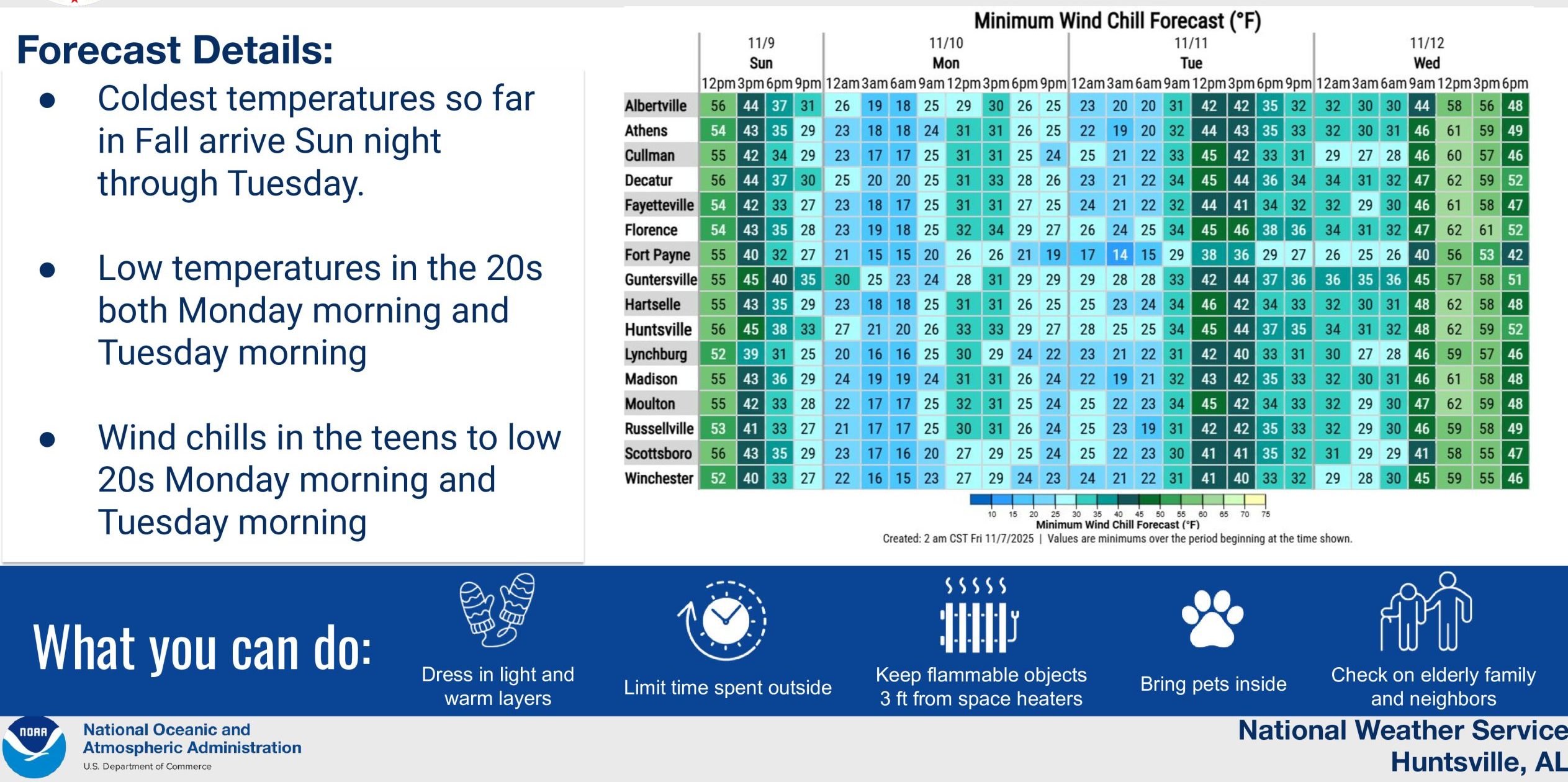
In fact, the National Weather Service Huntsville Office is saying an agricultural killing freeze with near-record to record daily low maximum and minimum temperatures is expected Monday and Tuesday mornings.
For this afternoon and tonight, there is a low threat for severe weather, the forecasters said. Most areas will see rain, some will have thunder but very few will get any damage from severe weather.
The severe weather threat for Saturday has been removed, the weather service said.
Then, comes the beginning of the week.
We should expect low temperatures in the 20s Monday and Tuesday mornings. And, if that isn’t cold enough, wind chills will be in the teens to low 20s both mornings.
After the blast, temperatures should moderate into the 50s and 60s for the rest of the week.