HUNTSVILLE — Don’t put those coats and scarves away, just yet. It’s going to be a bone-chilling night and drive to work Wednesday morning.
Ol’ Man Winter has decided he’s still hangin’ around for at least another night and then he’ll move out to bring us more springlike temperatures rather than fall-like.
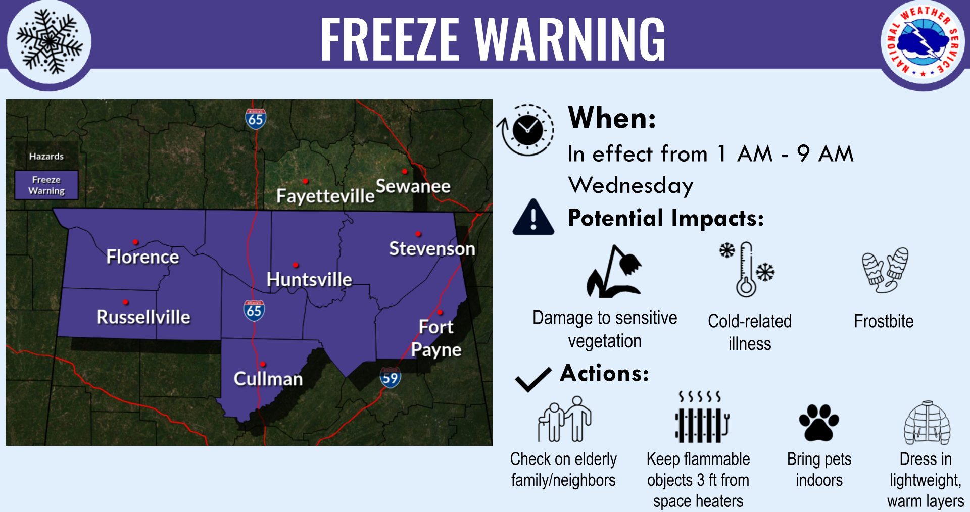
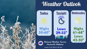 A Freeze Warning is in effect for every county across North Alabama from after midnight tonight to 9 a.m. Wednesday, according to the National Weather Service Huntsville office.
Forecast lows are in the 28- to 33-degree range and conditions will support the development of widespread frost, as well.
Highs are forecast to top out in the 50s today, with lows plummeting into the upper 20s to lower 30s tonight.
Temperatures will then begin to warm up Wednesday afternoon, with highs in the 60s and lows Wednesday night in the 40s.
There won’t be any rain during this time no rain through midweek but storms are in the forecast for Thursday.
Clusters of strong to marginally severe storms ahead of a cold front are anticipated for North Alabama and and southern middle Tennessee, the weather service said.