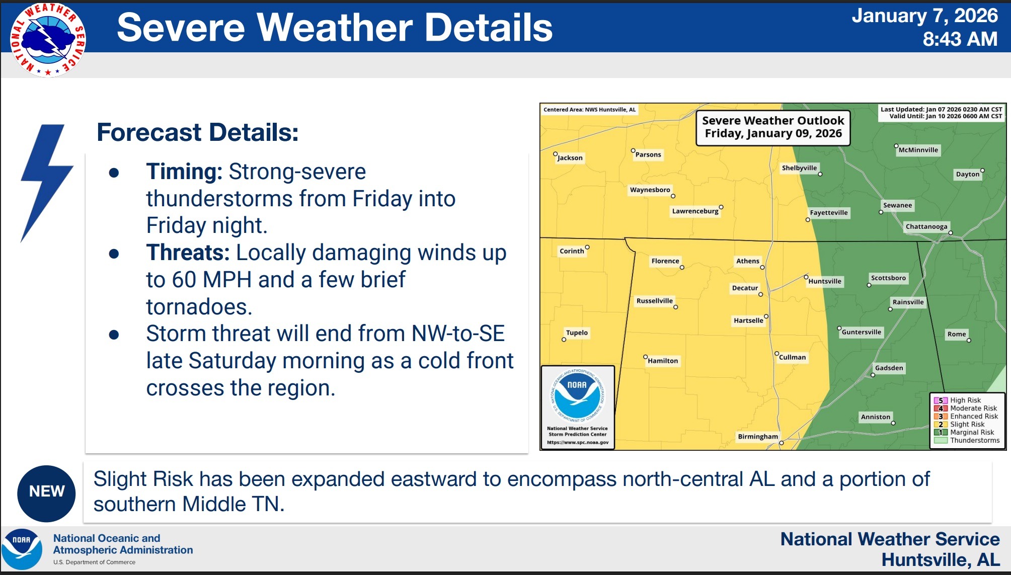
Forecasts from the National Weather Service in Huntsville call for multiple rounds of heavy rain Friday into overnight, with the potential for strong to severe thunderstorms across the region.
Confidence is highest in the threat for heavy rainfall and possible flooding impacts, including flash flooding and water ponding on roads. There is more uncertainty surrounding the timing and overall risk for damaging winds or tornadoes.
According to the National Weather Service, the heaviest rainfall is expected between about 4 p.m. Friday and 2 a.m. Saturday, when repeated rounds of rain and thunderstorms could move through the area.
Forecasters are predicting Friday’s setup as a complicated weather scenario rather than a fast moving, organized line of storms. The National Weather Service warns periods of heavy rain could lead to a flooding threat Saturday morning.
Officials encourage people to monitor forecasts closely, have multiple ways to receive weather warnings and use caution when traveling during periods of heavy rain, especially at night when water on roadways can be harder to see.
Additional updates are expected.