HUNTSVILLE — Despite what Porky Pig says, that ain’t all folks!
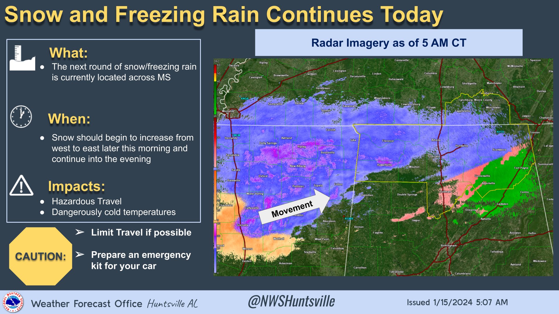
After a brief lull in precipitation overnight, our next round of snow/freezing rain is moving north and east across Mississippi, according to the National Weather Service Huntsville office.
“It is expected to move into northern Alabama later this morning,” the office said in a X post at 5:15 a.m. “Hazardous travel and dangerously low temperatures are expected today.’
[5:15 am] Speaking of dangerously cold temperatures, overnight lows drop down into the single digits tonight with wind chills 5 to 10 degrees below zero by Tuesday morning. Similar conditions are expected Wednesday morning. #HUNwx (2/2) pic.twitter.com/146iVB2qaj
— NWS Huntsville (@NWSHuntsville) January 15, 2024
Gov. Kay Ivey declared a state of emergency Sunday for 25 counties: Blount, Calhoun, Cherokee, Cleburne, Colbert, Cullman, DeKalb, Etowah, Fayette, Franklin, Jackson, Jefferson, Lamar, Lauderdale, Lawrence, Limestone, Madison, Marion, Marshall, Morgan, Pickens, St. Clair, Tuscaloosa, Walker and Winston.
“We are anticipating unusually cold temperatures in Alabama this week, so I am urging everyone to be prepared, take caution traveling and stay weather aware,” she said.
The weather service has also warned that freezing rain/ice is possible over the entire area. The greatest chances for ice accumulations of less than a quarter-inch over the higher terrain in northeast Alabama and southwest into Cullman County.
The office said dangerously cold conditions are expected Tuesday through Thursday morning, but the forecast is trending slightly colder Tuesday morning and not as cold Wednesday morning.
- Tuesday: Temperatures Tuesday morning in the single digits to lower teens with wind chills 5 to 10 degrees below zero. Afternoon highs top out in the mid 20s
- Wednesday: Morning lows drop down into the low single digits with wind chills 5 to 10 degrees below zero. Afternoon highs only top out in the lower 30s
- Thursday: Temperatures finally go above freezing in the late morning