HUNTSVILLE — Here comes that rainy day feeling, again.
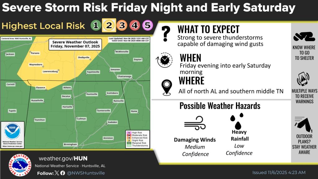
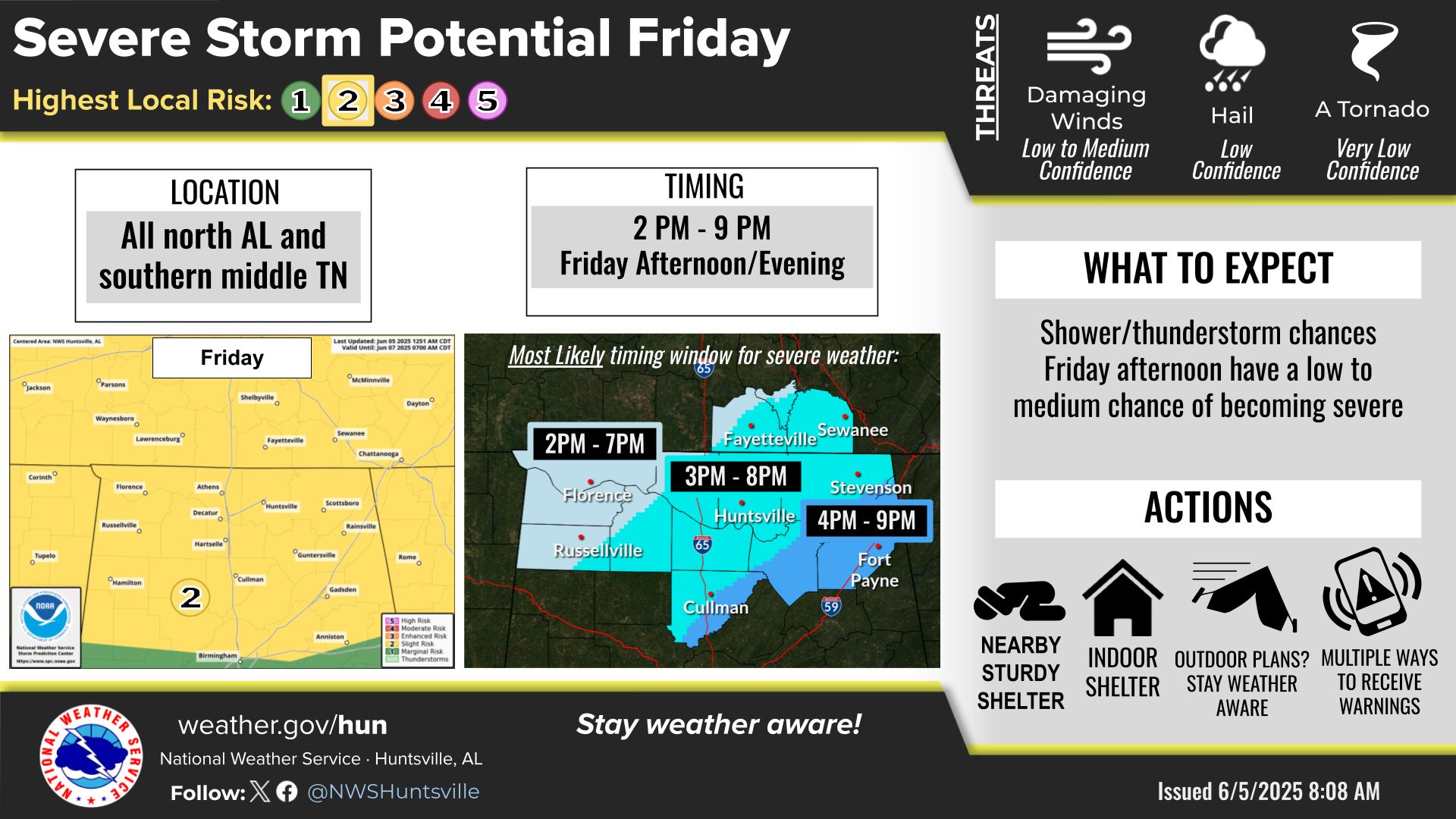
Strong to severe storms are expected to move in from the west this afternoon into the late evening, according to the National Weather Service Huntsville office.
The slow-moving cold front moving into the Tennessee Valley will support the development of severe storms and flooding Saturday as well, with damaging winds and hail the main threats.
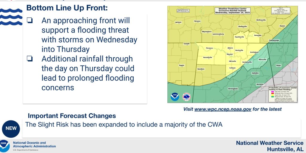
There is also a threat for excessive rainfall, bringing a potential of flash flooding, and rising rivers, streams and creeks.