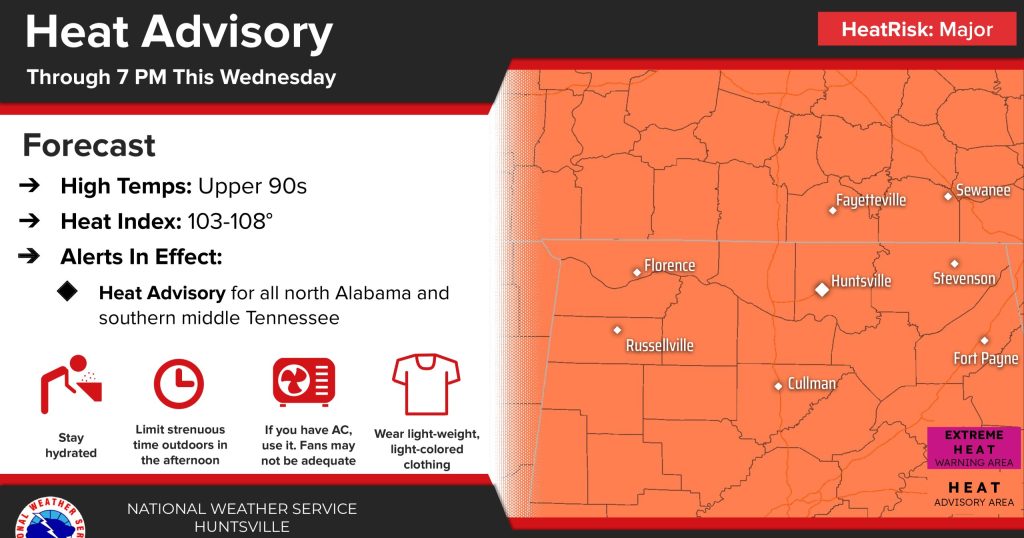
HUNTSVILLE — Oh, the weather may be frightful over the next couple days as spring-like temperatures are blown away for subfreezing temperatures across North Alabama.
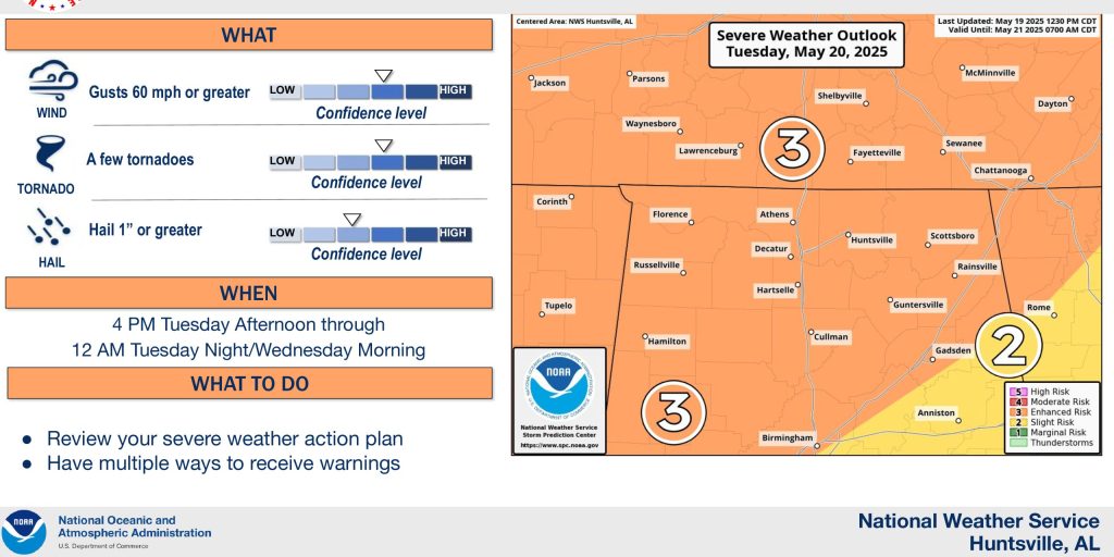
The National Weather Service Huntsville Office is calling for thunderstorms capable of damaging wind gusts up to 50-60 mph Friday evening into Saturday morning.
There will be another round of strong to severe storms Saturday night, also with the potential for damaging wind gusts.
The storms are ahead of the coldest airmass of the season which will bring the first sub-freezing temperatures this fall into the area Sunday night.
The weather services say there are medium to high chances of below-freezing temperatures Monday and Tuesday mornings.
Temperatures will struggle to reach to low 40s Monday and in the mid-20s early Tuesday.
The Arctic snap is short-lived with milder temperatures in the 60s returning Wednesday.