HUNTSVILLE – Scientists from the University of Alabama in Huntsville are preparing to study hurricane characteristics to better predict the intensity of these storms before they make landfall. Hurricane season officially started last Thursday.
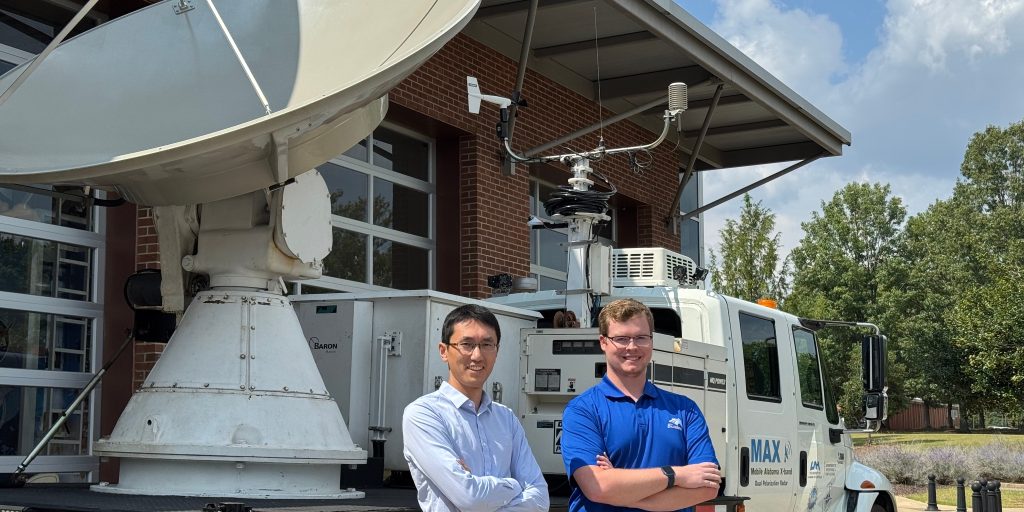
Dr. Xiaomin Chen, assistant professor in the Department of Atmospheric and Earth Science, is collaborating with Dr. Kevin Knupp, director of UAH’s Severe Weather Institute – Radar and Lightning Laboratories, to focus on near-surface localized wind gusts.
Two students in the department – graduate student Kiahna Mollette and undergraduate senior John Mark Mayhall – will each work with a NASA program to study lightning and cloud formation.
Greater accuracy in forecasting hurricane intensity will enable atmospheric scientists to
better inform the public of the potential devastation and how to prepare for it.
“Very little data has been collected on near-surface localized wind gusts, as it’s not
permitted for aircraft to fly that low to the ground,” said Chen. Researchers must be on the ground in the path of a landfalling hurricane to collect this data.
Chen and Knupp plan to deploy UAH’s Mobile Atmospheric Profiling Network fleet of
research vehicles to study hurricanes anticipated to make landfall along the Gulf Coast.
The network is a National Science Foundation-funded
facility that is part of the Community Instrument and Facility suite.
UAH’s research vehicles are equipped with instrumentation to collect real-time localized
wind gust data before and during a hurricane making landfall.
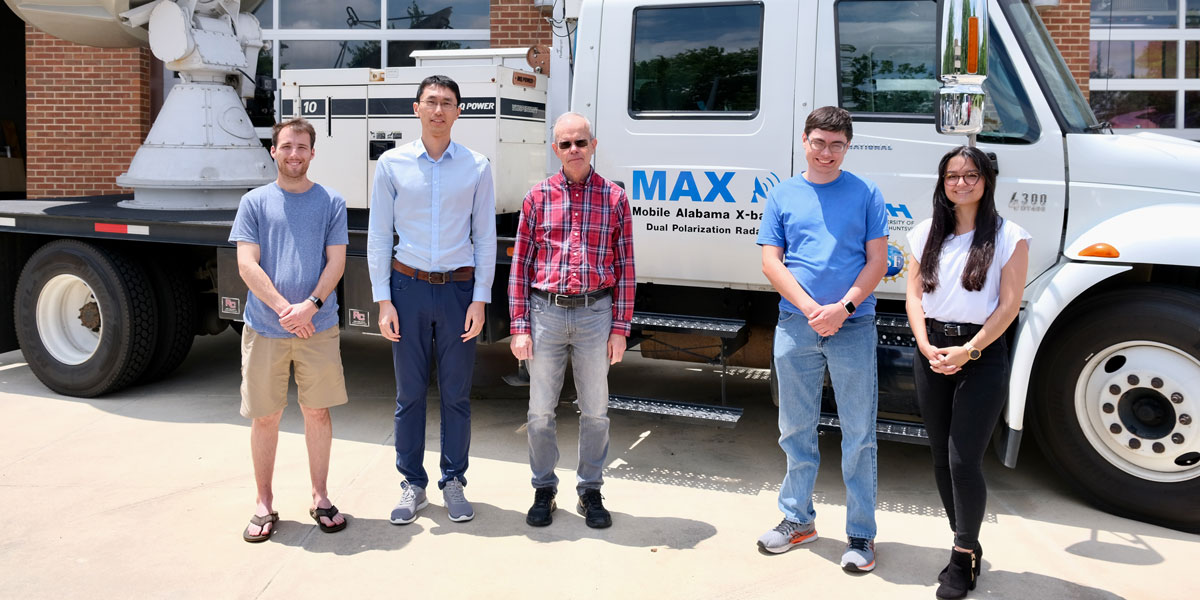
To assist with these deployments, Chen and Knupp will form a team of undergraduate
and graduate researchers from the department and train them to take proper safety
precautions.
Mollette and Mayhall will work with the Marshall Space Flight Center Short-term
Prediction Research and Transition Center (SPoRT) program in hurricane rapid
intensity research under the advisement of NASA SPoRT civil servant Dr. Patrick
Duran.
“Currently, it’s difficult to determine what the intensity of a hurricane will be at landfall,”
Mollette said.
The National Hurricane Center defines rapid intensification as a change in sustained
winds of 30 knots, or 35 miles per hour, within 24 hours. The National Hurricane Center
is working to improve its hurricane intensity forecast as hurricanes can rapidly intensify
in less than 24 hours.
Mollette uses data from NOAA’s Geostationary Lightning Mapper aboard the
Geostationary Operational Environmental Satellite East to study the brightness of
lightning flashes that occur in the inner eyewall of a hurricane and its relationship to
hurricane intensity. The brightness of a lightning flash is known as optical energy.
“By studying the relationship of optical energy and hurricane rapid intensification, we
may be able to observe a hurricane intensifying in near real time, thus allowing
operational weather forecasters to provide more lead time to the public of how strong a
hurricane will be once it makes landfall,” Mollette said.
Mayhall is studying whether bands of cirrus clouds generated from a hurricane’s outflow
is a precursor to rapid intensification.
“When a hurricane begins to strengthen,” he said, “a lot of air is evacuated from the
eyewall and pushed outward in all different directions, creating what’s called an outflow.
This outflow of air can create bands of cirrus clouds.”
Mayhall said the tricky part of his research is that bands of cirrus clouds can be
produced by hurricanes in multiple ways, not just from outflows.
Chen, Knupp, Mollette and Mayhall will be closely monitoring the potential of hurricanes
through Nov. 30, the official end of hurricane season.