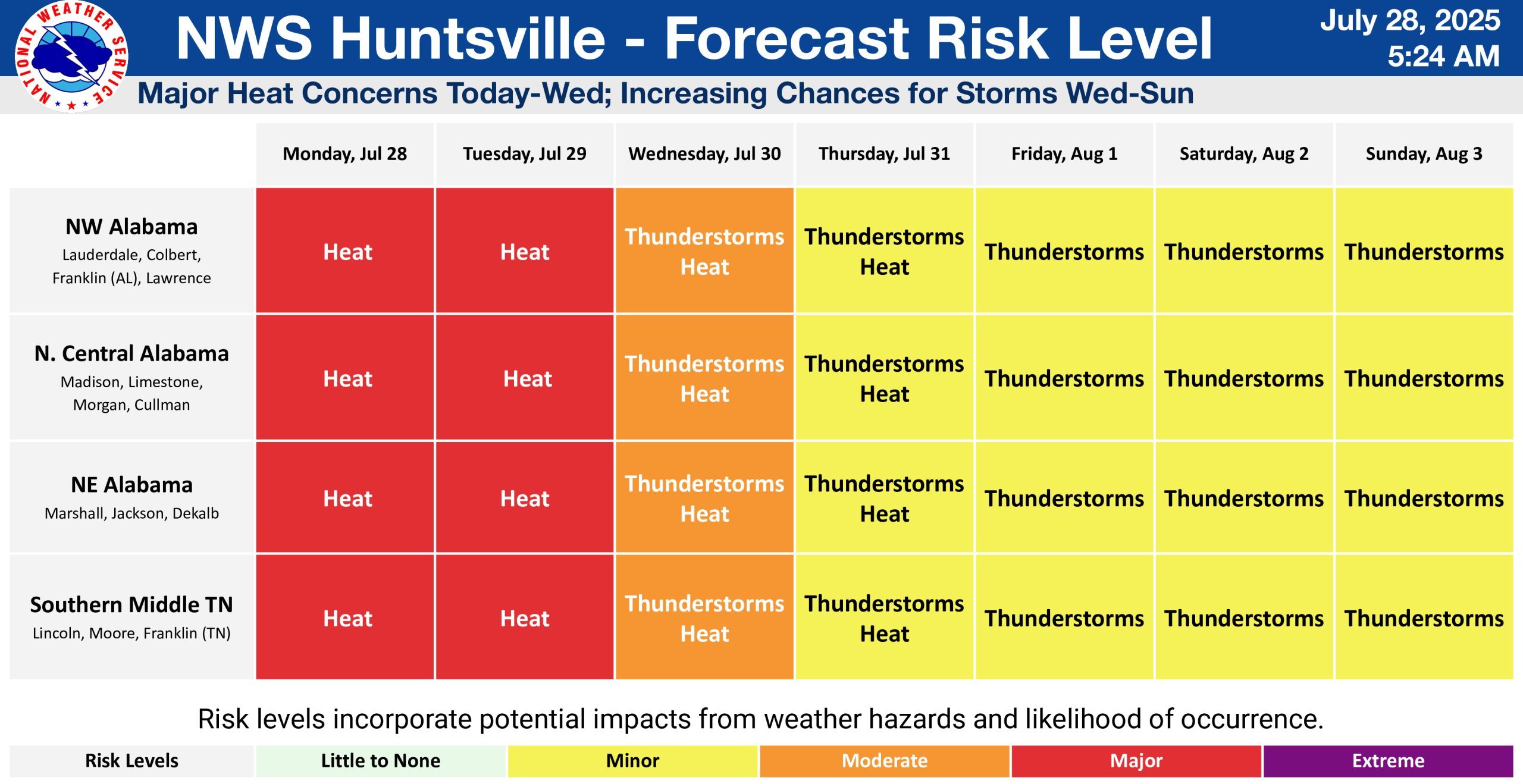
HUNTSVILLE — This week ahead is going to start with some of the highest temperatures and heat indexes in a couple years with some strong storms and possible flooding at the end.
The National Weather Service Huntsville office has issued a heat advisory through 9 p.m. Tuesday. The office may issue an extreme heat warning, as well, because some areas may see heat indices approach 115 degrees.
The high temperatures are forecast be in the lower to mid-90s today and the mid- to upper 90s Tuesday.
The chances of rain increase through the week, according to the office.
Today, there is a 20-40% chance for showers/thunderstorms as a system moves into the region from western and Middle Tennessee. The storms could have an impact on temperatures depending on when they arrive. The forecasters say a few strong storms will be possible with threats of gusty winds and flooding.
Tuesday’s forecast calls for a 30-40% chance of showers/thunderstorms. The storms will be moving west-southwestward from higher terrain to the northeast late in the day. Forecasters say very unstable conditions may support a few severe thunderstorms with threats of damaging winds and flooding.
From Wednesday to Sunday, there are high chances for showers and thunderstorms during the day and at night, with multiple rounds of heavy rainfall leading to an increasing concern for flooding.
The good news, heat-wise, is the clouds and precipitation will keep temperatures relatively cooler during this time.