HUNTSVILLE — A few days into March and the month is coming in like a lion.
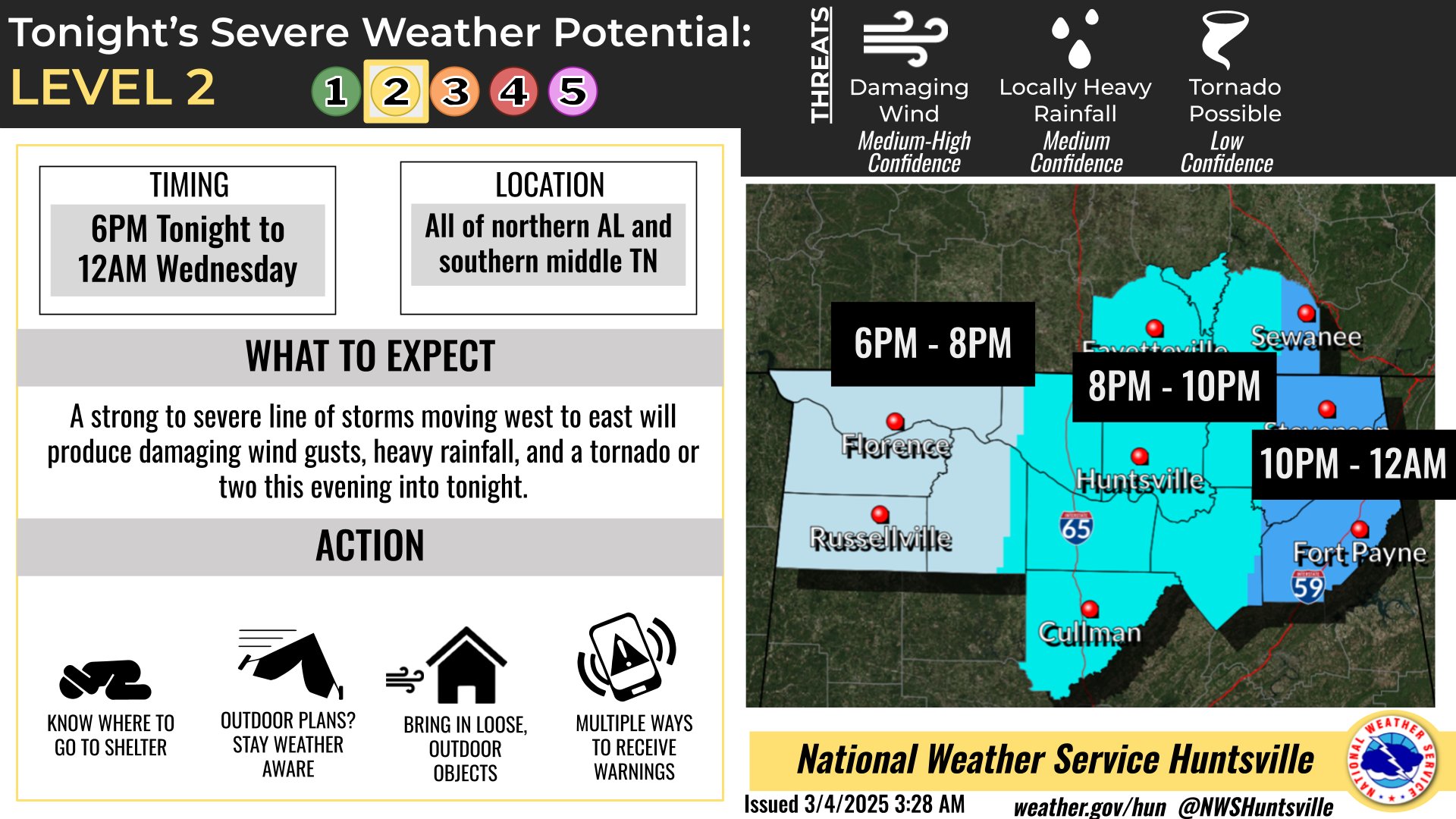
A risk of severe weather today and tonight returns for much of North Alabama, according to the National Weather Service Huntsville office.
The forecast threat includes damaging winds, heavy rainfall and a small chance of tornadoes.
A Wind Advisory will be in effect for all of north Alabama and southern Middle
Tennessee from noon today to 3 p.m. Wednesday.
Non-thunderstorm winds of more than 35 mph are likely at times this afternoon through
Wednesday afternoon, ahead of and behind a line of strong to severe storms. Gusts of 40-55 mph will occur this afternoon and evening just ahead of the line of storms.