HUNTSVILLE — Ol’ Man Winter is about to pay a visit to the Tennessee Valley. And he’s bringing his pal Jack Frost along for the ride.
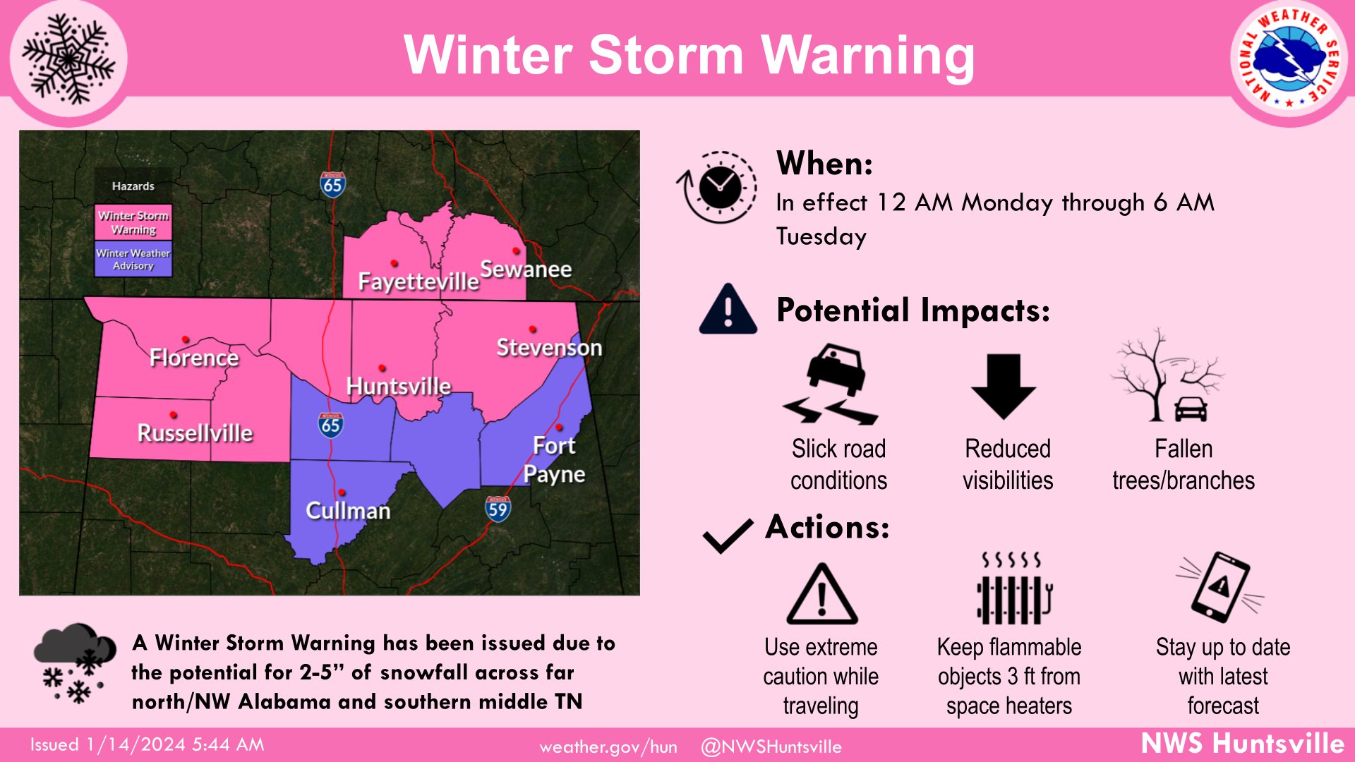
A strong arctic cold front will move into the region tonight, bringing frigid conditions and the potential for up to five inches of snow, calling for a Winter Storm Warning.
The winter storm warning is in effect for Marion, Winston, Franklin, Lawrence, Colbert, Lauderdale, Limestone, Madison, and Jackson counties. A winter weather advisory was issued for Lamar, Fayette, Cullman, Morgan, Marshall, Blount, Etowah, Cherokee, and DeKalb counties.
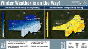
“Highest accumulations up to 5 inches in northwest Alabama and southern Middle Tennessee with isolated higher amounts are possible,” the National Weather Service Huntsville office said.
South of the Tennessee River, there is a chance of freezing rain and ice forming on the roads and power lines, the office said.
“Freezing rain/ice is possible over southeast portions of the … area where a warm layer may exist above freezing surface temperatures,” the forecast said. “The greatest chances for ice accumulations up to 0.15 inch is over the higher terrain in northeast Alabama and southwest into Cullman County.”
After the snow, dangerously cold conditions are expected Tuesday through Thursday morning with “dangerously low wind chills (minus-5 to minus-10 degrees)” Wednesday morning.
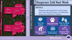
“There will also be a prolonged period of sub-freezing temperatures for much of the area spanning (tonight) through Thursday morning. Areas south of the river may briefly touch above freezing Monday afternoon.”
- Tuesday
Morning temperatures in the morning in the mid to upper teens with wind chills in the single digits to near zero in Northwest Alabama.
Afternoon highs top out in the mid 20s and then drop into the single digits overnight - Wednesday
Morning lows drop down into the low single digits with wind chills 5 to 10 degrees below
zero.
Afternoon highs only top out in the upper 20s with wind chills in the teens. - Thursday
Temperatures finally go above freezing in the late morning