HUNTSVILLE — That may not be snoring you hear late tonight.
It will be some clouds that go bump in the night.
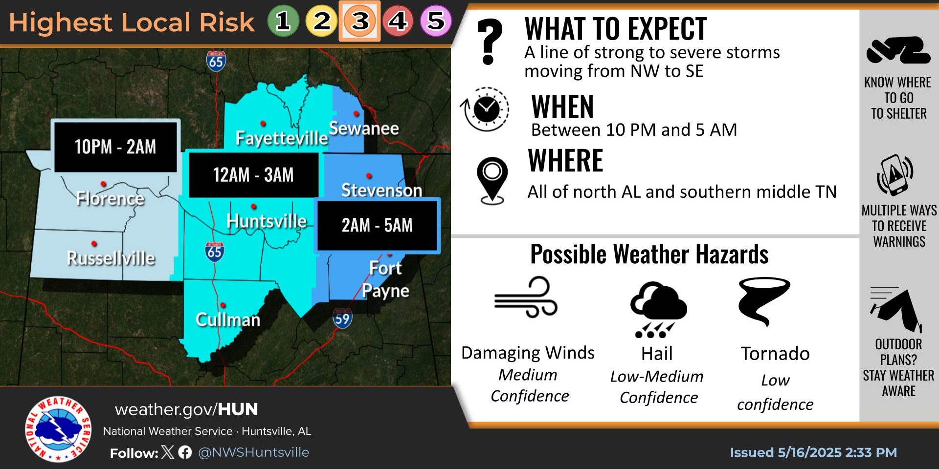
A line of strong to severe storms approaching from the northwest is expected to roll into the Shoals by 10 o’clock tonight, the National Weather Service Huntsville office is forecasting.
The cluster of storms then is expected to reach I-65 by midnight and northeast Alabama around 2 a.m. Damaging winds (60 mph), large hail (1-2 inches in diameter), and a few tornades are possible, the weather service said.
The potential for severe weather this weekend is also in the forecast.
“Showers and storms may redevelop during the evening/overnight hours Saturday as a surface front lifts back north over the region,” the forecasters said. “Additional storms may linger overnight into Sunday along the boundary.
“A few storms may become strong to severe, with damaging winds and hail the main
threats.”