HUNTSVILLE — Just when we thought we were out of the storms.
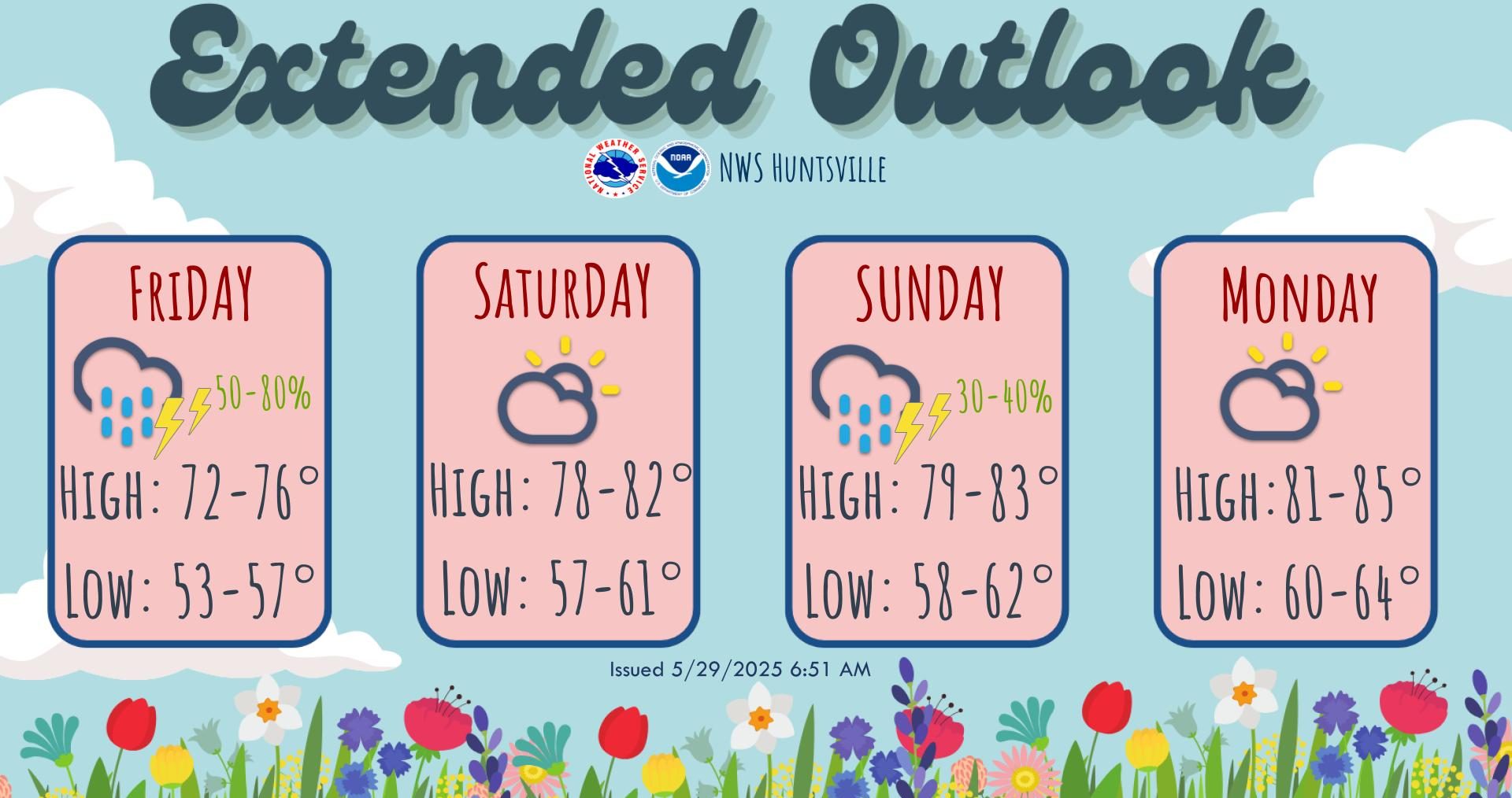
Strong to severe thunderstorms will be possible across the region Friday morning as a cold front arrives in The Shoals around dawn, the National Weather Service Huntsville office said.
“Conditions will become more favorable for strong to severe thunderstorms after midnight, both with cells developing ahead of a cold front, 4-7 a.m., and the actual cold front, 7 a.m. to noon,” the forecasters said. “The main impacts will be damaging winds up to 60 mph, hail up to 1 inch in diameter and perhaps a few brief tornadoes.”
The cold front (and risk for strong-severe storms) will spread southeastward quickly after sunrise Friday, exiting the region by noon. The forecast calls for gusty northwest winds as well as wrap-around clouds and light rain are expected Friday afternoon and evening.
There’s some respite Saturday but a cold front will interact with a destabilizing air mass Sunday morning to bring an additional round of storms Sunday afternoon and evening, some of which could produce gusty winds and small hail.
Dry conditions will prevail early next week, with a gradual increase in shower and storm chances by Wednesday.