
HUNTSVILLE — If it’s not one thing, it’s another.
The National Weather Service Huntsville office has issued a pair of dueling threats for today.
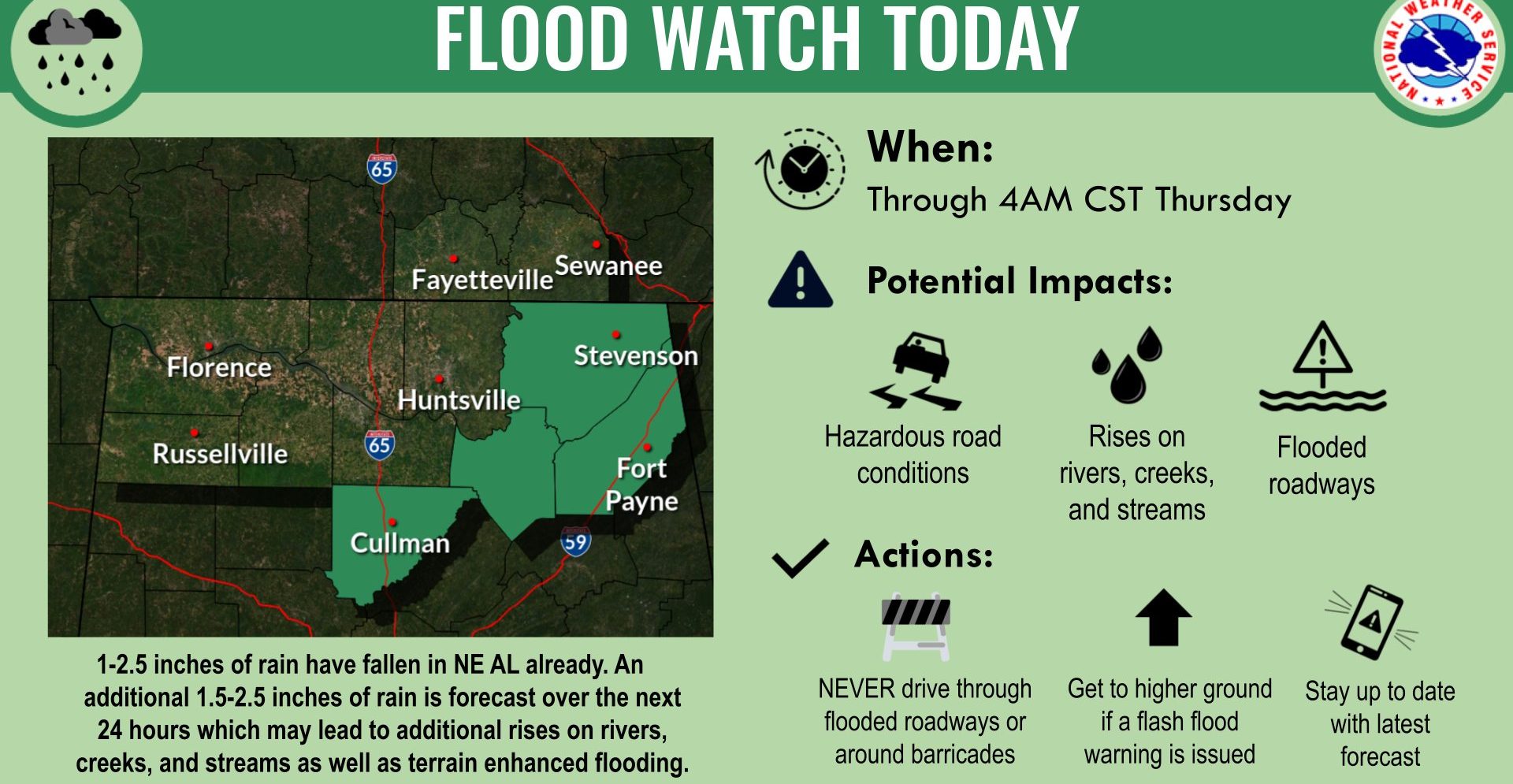
- A flooding threat continues with a flood watch for Northeast Alabama through early Thursday.
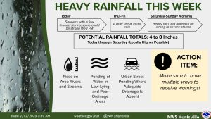
The office is monitoring the severe threat for tonight while heavy rainfall and some thunderstorms are forecast through the day as a front moves through the area.
Meanwhile, there may be a third threat in the forecast Friday – from the “When it rains, it pours, then it freezes” chapter. Subfreezing temperatures (mid-20s) Friday morning will create a risk of black ice in areas where water lingers on roadways.
The high temperatures today will be in the low to mid-50s with overnight lows near freezing. The highs for Thursday will range from 47 to 56 degrees and the temperatures will drop into the mid- to upper 20s into Friday morning.


