HUNTSVILLE — Batten down the hatches. It looks like we’re in for some heavy rains today and Saturday.
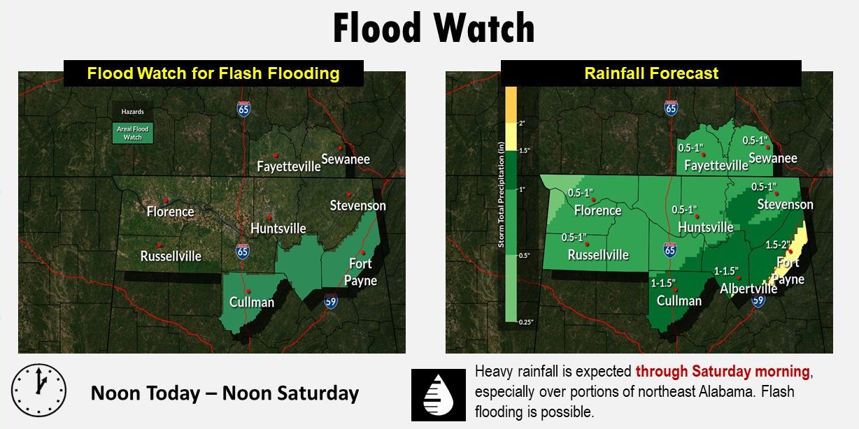
In fact, a flood watch is in effect for Dekalb, Marshall, and Cullman counties due to the potential for one to two inches of rain through Saturday morning.
The culprit, according to the National Weather Service Huntsville office, is a cold front coming through the area.
“High rain chances will be present from today into Saturday morning as a cold front
moves through,” the NWS said this morning. “Some strong to severe storms will be possible this afternoon and Saturday morning. Between one-half to two inches of rain is currently forecast for our area with locally higher amounts possible.
“Rainfall will likely result in rises in rivers and creeks across the area.”
There are high chances of showers and storms today (80-90%) with low to medium chances (20-50%) of showers and storms lingering into Saturday afternoon, according to the forecast.
“The best chances for strong to severe storms will be this afternoon and Saturday morning around sunrise,” the NWS said.
The weather office said the front will bring winds with gusts up to 25-35 mph possible; strong gusts are possible in areas of higher elevation.
While it is a cold front, temperatures are expected to be moderate with afternoon highs today and Saturday in the 60s to around 70 today and in the 50s to around 60 Sunday. Morning lows will be mainly in the 30s Sunday into Tuesday.