HUNTSVILLE — Though Tropical Storm Helene continues to weaken as it tracks inland, it is expected to bring heavy rainfall and gusty winds to the Tennessee Valley.
The last few radar scans show that it is starting to turn to the northwest and track into Tennessee later today, where it will stall and stay in place through the weekend.
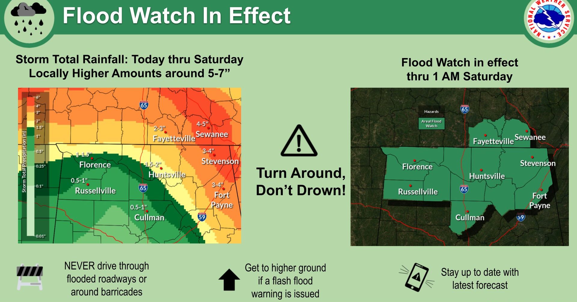
However, rainfall coverage and intensity are expected to diminish considerably beginning Saturday, according to the National Weather Service Huntsville office.
Current forecasted rainfall totals through late tonight range from a half-inch to 1 inch in areas west of I-65 to 3-5 inches in northeast Alabama, with the majority of this expected to occur between now and 10 a.m.
A flood watch and wind advisory will remain in effect until 1 a.m. Saturday to account for these threats as Helene passes to the east and north.
Some areas may see localized totals up to 5-7 inches. Flash flooding will be a concern through the remainder of the day as the tropical rain bands move through the area.
Any rain combined with gusty winds means it will be easier for trees to fall due to loosened soils. Wind gusts 30-40 mph are forecast to impact the entire area through this evening.