HUNTSVILLE — There is a threat of severe weather for the Tennessee Valley today, according to the National Weather Service’s Huntsville office.
Madison County is under a tornado watch until 1 p.m.
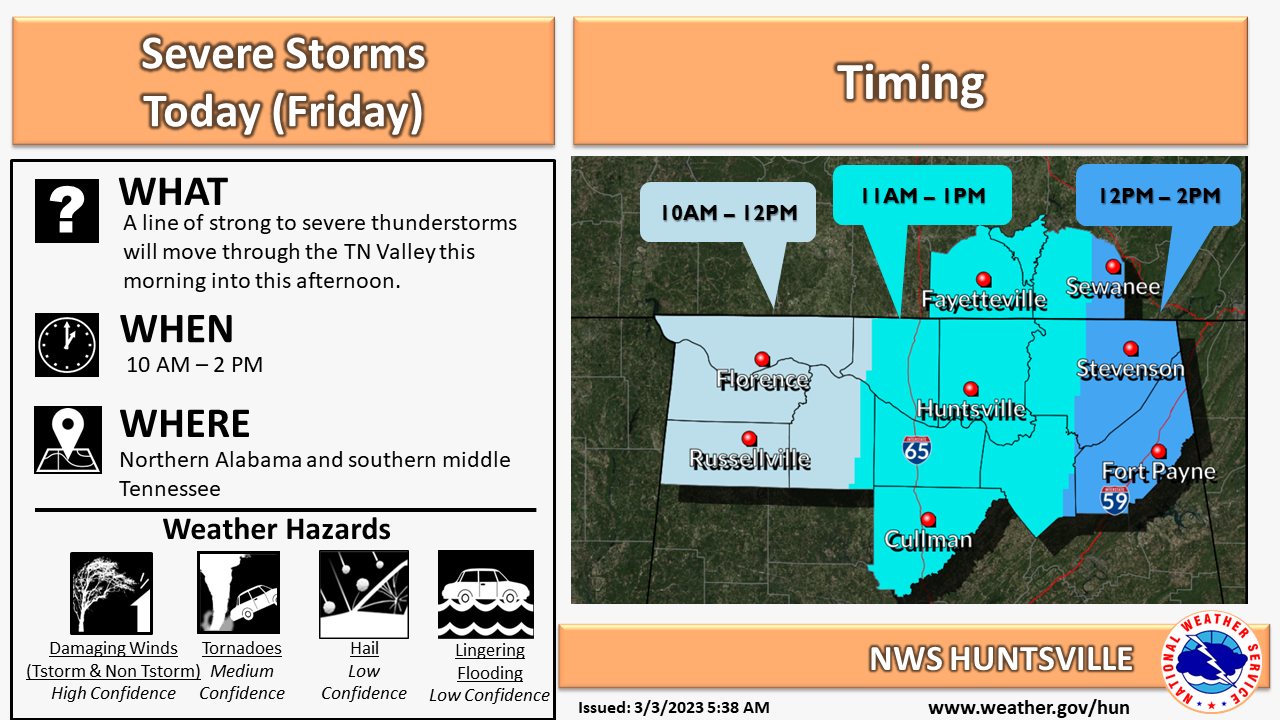
The storms are expected to arrive around 10 a.m. in northwest Alabama from the west then continue eastward, the weather service said. Damaging winds, tornadoes, hail, and flooding are all possible.
A high-wind warning is in effect. The weather service said there is a potential for non-thunderstorm wind gusts up to 65 mph with locally higher gusts possible throughout today.
These winds will likely result in power outages and downed trees, particularly due to saturated soils as a result of recent rainfall. The gusts will cause hazardous travel for high-profile vehicles.
In Decatur, Austin High School and Decatur High School will be opened as storm shelters at 10 a.m.
Residents can also seek shelter at Decatur City Hall and the Morgan County Courthouse basement while the threat for severe weather remains.
Those with domestic animals (cats/dogs) may seek shelter at City Hall as long as animals are kept on a leash or in a crate. Animals are not allowed in the school shelters.
Firearms, alcohol or tobacco products will not be allowed in any storm shelters.