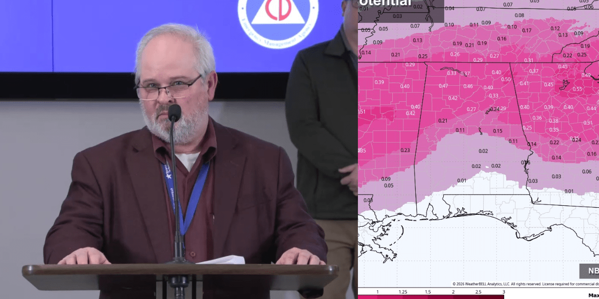
Local officials outlined preparations at a Wednesday news conference for a potentially dangerous winter weather event expected to impact Huntsville, Madison, and surrounding areas Friday evening through Sunday.
The briefing, held at Madison County EMA headquarters, included Madison County EMA Director Jeff Birdwell, Mayor Tommy Battle, Madison Mayor Ranae Bartlett, Madison County Chairman Mac McCutcheon, and officials from law enforcement, fire, and medical services.
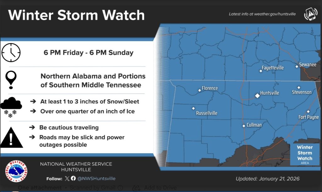
The National Weather Service (NWS) has issued a Winter Storm Watch from 6 p.m. Friday through 6 p.m. Sunday, predicting one to two inches of snow mostly north of the Tennessee River and at least a quarter-inch of ice across the area.
Temperatures are expected to remain below freezing through early next week, raising the risk of icy roads and power outages.
Pre-treating roads likely limited
Officials warned that rain leading up to the storm makes widespread pre-treatment of roads difficult.
“If we were out there pretreating this morning, that would all be gone come Friday. Nearly half of the winter weather events we have, pretreatment is limited by rain that precedes the event. It’s not uncommon,” Seth Burkett of the Alabama Department of Transportation said.
“What we will prioritize is bridges going into the event, which can be handled in a shorter window of time.”
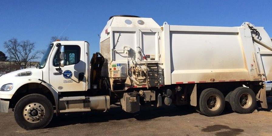
Chris McNeese, Huntsville Public Works director, added, “When we see any accumulation begin, we’ll hit it with modified granular material. It helps keep surfaces safer for any traffic that may be out.”
Alabama EMA’s latest statewide update warns temperatures near and north of I-20 may fall below freezing around midnight Saturday and could stay below freezing into at least Tuesday afternoon, complicating travel and recovery.
Coordination across agencies
Madison County EMA Director Jeff Birdwell said local authorities are working closely together to prepare for the potentially dangerous weather event alongside.
“This will be a regional effort. The City of Huntsville, the City of Madison, and Madison County are working together around the clock. Behind us are thousands of employees and first responders ensuring essential services continue and the community remains safe.”
The NWS Winter Storm Watch runs 6 p.m. Friday through 6 p.m. Sunday and the agency’s current call is 1-2 inches of snow/sleet mainly north of the Tennessee River, alongside over ¼ inch of freezing rain possible area-wide.
NWS Huntsville is also showing medium (roughly 40-70%) odds of at least 0.25″ of ice across its forecast area from Friday through Sunday night, an amount tied to tree damage and power outages.
Huntsville Mayor Tommy Battle stressed the importance of preparation.
“Our purpose today is to make certain our community is prepared. Communications will be crucial, and we’ll provide daily updates through City Alerts, social media, and our website. Check on your neighbors, especially seniors, and make plans now for potentially dangerous days.”
Neighboring Huntsville, Madison Mayor Ranae Bartlett affirmed the message of safety and preparation.
“Our Public Works and Public Safety departments are ready for any scenario. Please stock up on groceries and medicines and stay home if you can. Your safety is our priority.”
Utilities and emergency services ready
Chris Jones, Huntsville Utilities COO, detailed steps that are being taken to minimize danger for utility personnel, including linemen, in cases where local power needs to be restored.
“We’ve staged equipment in hard-to-access areas and have scaled up our staffing. Freezing rain is our biggest concern, especially on power lines and trees, but we’re ready to respond to whatever develops.”
Sheriff Kevin Turner said deputies will monitor hazardous roads, particularly in rural areas.
“Public safety doesn’t stop for a weekend event. We’ll have additional deputies on duty, and we encourage residents to follow barricades and traffic alerts. Your patience helps keep everyone safe.”
Police Chief Gandy of Madison added, “If you don’t have to be out, don’t go out. Roads will be treacherous, and barricades are for your safety. Officers will prioritize high-priority calls first.”
NWS forecast highlights
- Snow/Sleet: 1-2 inches, mostly north of the Tennessee River
- Ice: Over ¼ inch across the region
- Wind chills: Single digits to below zero Sunday and Monday nights
- Impacts: Hazardous driving, potential power outages, frostbite risk
- Duration: Friday evening through Sunday night; freezing temperatures expected through Tuesday or Wednesday
Officials stressed that limited commuter traffic over the weekend may reduce incidents, but residents are urged to remain vigilant.
“We are ready, but we need everyone to do their part. Stay home, stay informed, check on neighbors, and follow official updates,” Mayor Battle concluded.
“Together, we can weather this safely.”