HUNTSVILLE — Snow. Ice. Bitter cold temperatures. Single-digit wind chills. Gusty winds.
Welcome to the wild, wacky winter of North Alabama.
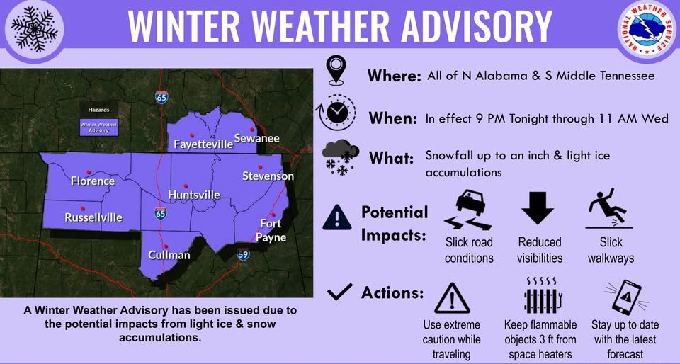
A light mix of rain, freezing rain and snow is possible this evening through Wednesday morning and a Winter Weather Advisory has been issued for all of the Tennessee Valley due to impacts from this light wintry mix.
An area of low pressure will quickly move eastward across the northern Gulf this afternoon through Wednesday evening bringing the wintry mix.
The snow.
Light snowfall accumulations up to an inch are possible with the highest accumulations likely in portions of southern middle Tennessee into northwest Alabama. A light dusting is more likely for Cullman, DeKalb and Marshall counties.
Then there’s the ice.
Light ice accumulations are more likely for parts of north central and northeast Alabama due to the probability for less snowfall. Portions of DeKalb and Marshall counties may see just light rain due to temperatures remaining just above the freezing mark.
And the bitter cold.
Today’s high temperatures will be in the low to mid-40s while Wednesday’s highs will be in the 30s. The high temperatures Thursday will only be in the low to mid-20s with wind chills in single digits thanks to winds gusting to 25 mph.
Weekend relief.
The area will leave the icebox Saturday afternoon when temperatures “climb” into the 40s and the 50s on Sunday.