HUNTSVILLE – The standard for measuring heavy snowfall has changed, not that it will come into play anytime soon despite the albeit small chance of a wintry weather mix overnight into the weekend.
Effective immediately for the 2023-2024 winter season, the National Weather Service is updating the heavy snow criteria for Winter Storm Watches and Warnings for our local area. The changes are minimal.
“We are only updating the heavy snow criteria for Winter Storm Watches and Warnings for our local area. All other winter hazard products for ice, blizzard, and wind chill will remain the same,” said Kate Guillet, warning coordination meteorologist for NWS Huntsville. “The changes are part of a national effort to better align the snowfall criteria with the local climatology of the area.
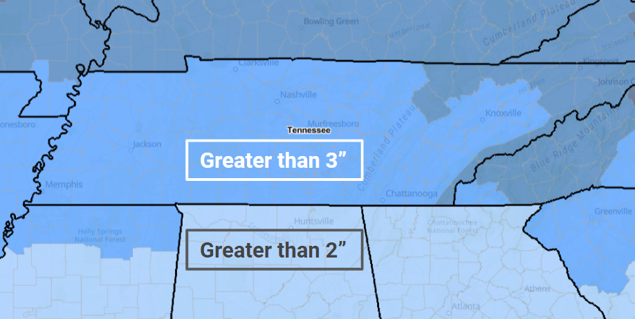
“The new criteria for a Winter Storm Warning for heavy snow for our area of responsibility is greater than two inches of snowfall in an event for Alabama and greater than three inches of snowfall in an event for our Tennessee counties. The Tennessee criteria matches the rest of Tennessee’s low level counties. The new criteria continues to allow the forecasters to issue or withhold watches and warnings in anticipation of expected impacts or lack thereof.”
- Old Heavy Snow Criteria:
Snowfall of 2-plus inches in 12 hours OR 4-plus inches in 24 hours for North Alabama - New Heavy Snow Criteria:
Greater than 2 inches of snowfall in an event statewide.
A white Christmas didn’t happen in the Tennessee Valley, no surprise there. But with the holidays still unfolding, there could still be a chance to see some snow before ringing in 2024.
The National Weather Service Huntsville forecast said today there is a low chance for a light rain-snow mixture from late tonight through early Saturday morning.
“While snow may occur, confidence is very low that we will see any accumulations across a vast majority of the area,” the Weather Service said. “As such, there are no snow accumulations in our official forecast.
“Any accumulations that do occur should be very light and focused on the higher elevations of southern middle Tennessee and far northeast Alabama.”