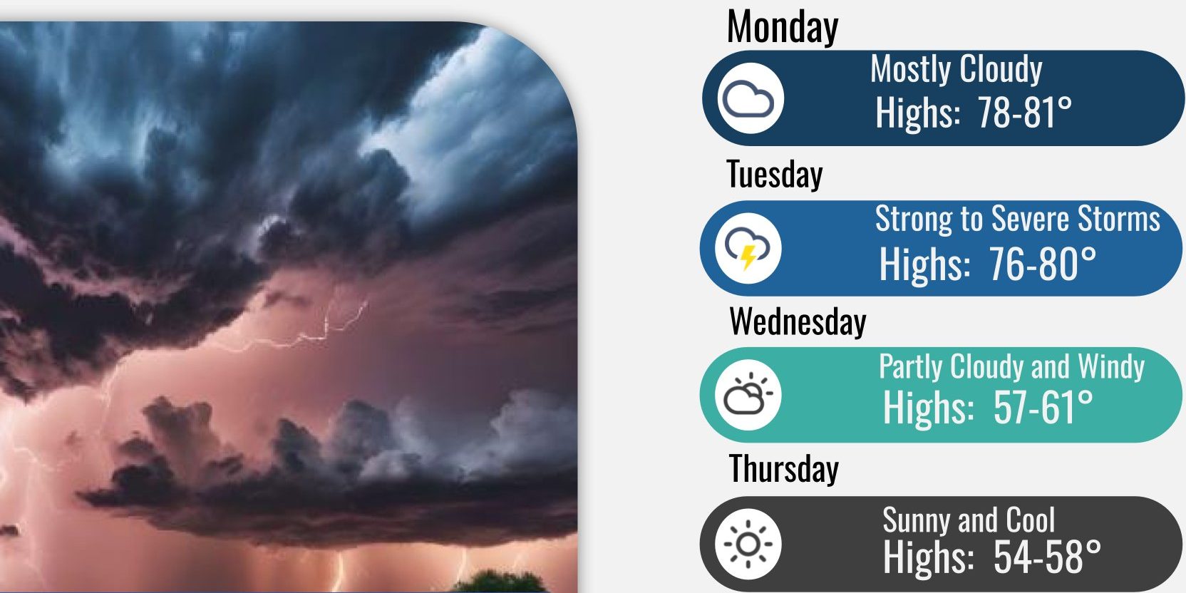
HUNTSVILLE — The calendar may read April 1, but the National Weather Service Huntsville office isn’t joking around today with its forecast for Tuesday.
“Strong-to-severe thunderstorms capable of producing damaging wind gusts of 60-70 mph (perhaps up to 70-80 mph), large hail (more than 1-inch in diameter) and a few tornadoes are expected across northern Alabama and southern middle Tennessee Tuesday afternoon and evening,” the office said this morning. “Damaging wind is the storm impact for
which we have high confidence in occurring tomorrow.”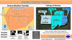
The office said the storms should roll into the Shoals between 2 and 5 p.m. Tuesday and move east before leaving northeast Alabama before midnight.
The storm system is the leading edge of an advancing cold front, the office said. The storms will intensify as they shift eastward into a destabilizing air mass across north Alabama through the remainder of Tuesday afternoon (in conjunction with the cold front).
The tail-end of the system will bring strong northwest winds in its wake Wednesday afternoon and evening and a Wind Advisory will likely be required.
“Sustained winds around 25 mph, with gusts of 35-40 mph are expected,” the forecast said. “Higher wind speeds and gusts are expected in elevated terrain.”