HUNTSVILLE — If the old adage of “April showers bring May flowers” holds true, then it should be really colorful next month as everything starts to bloom.
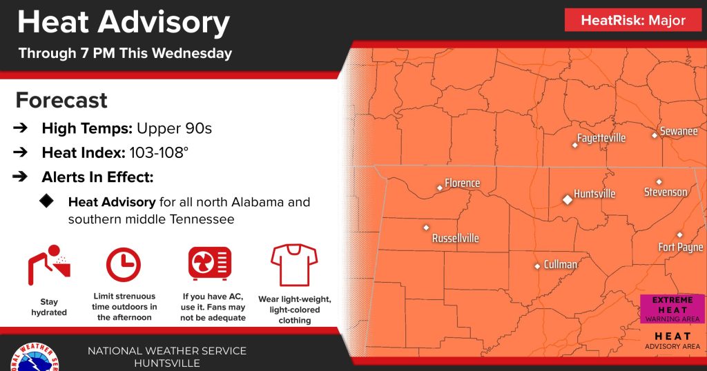
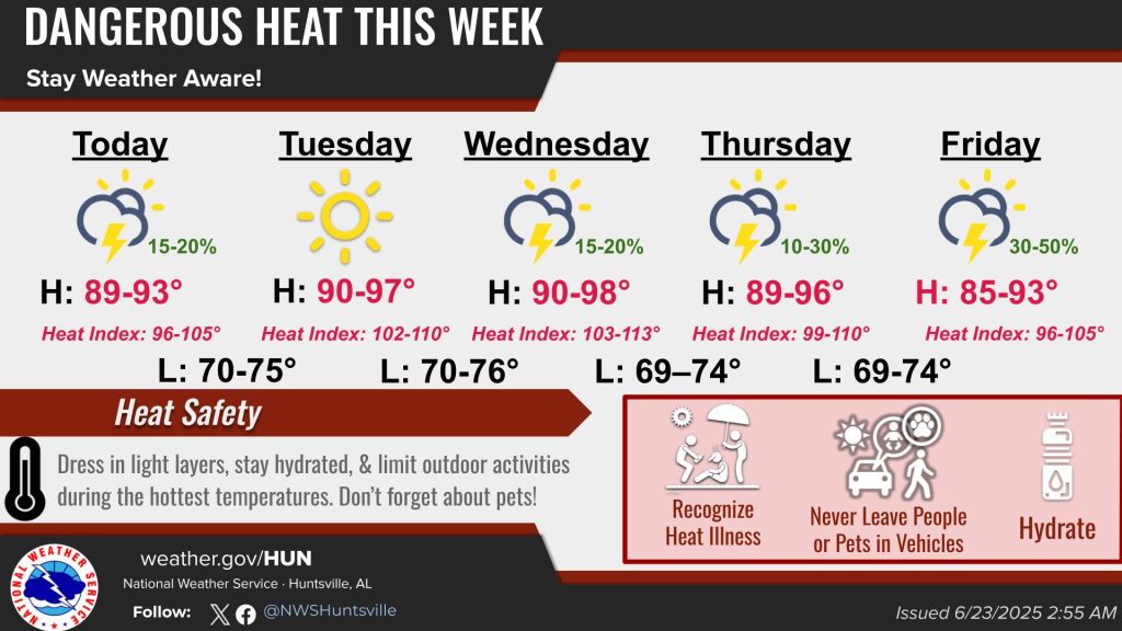
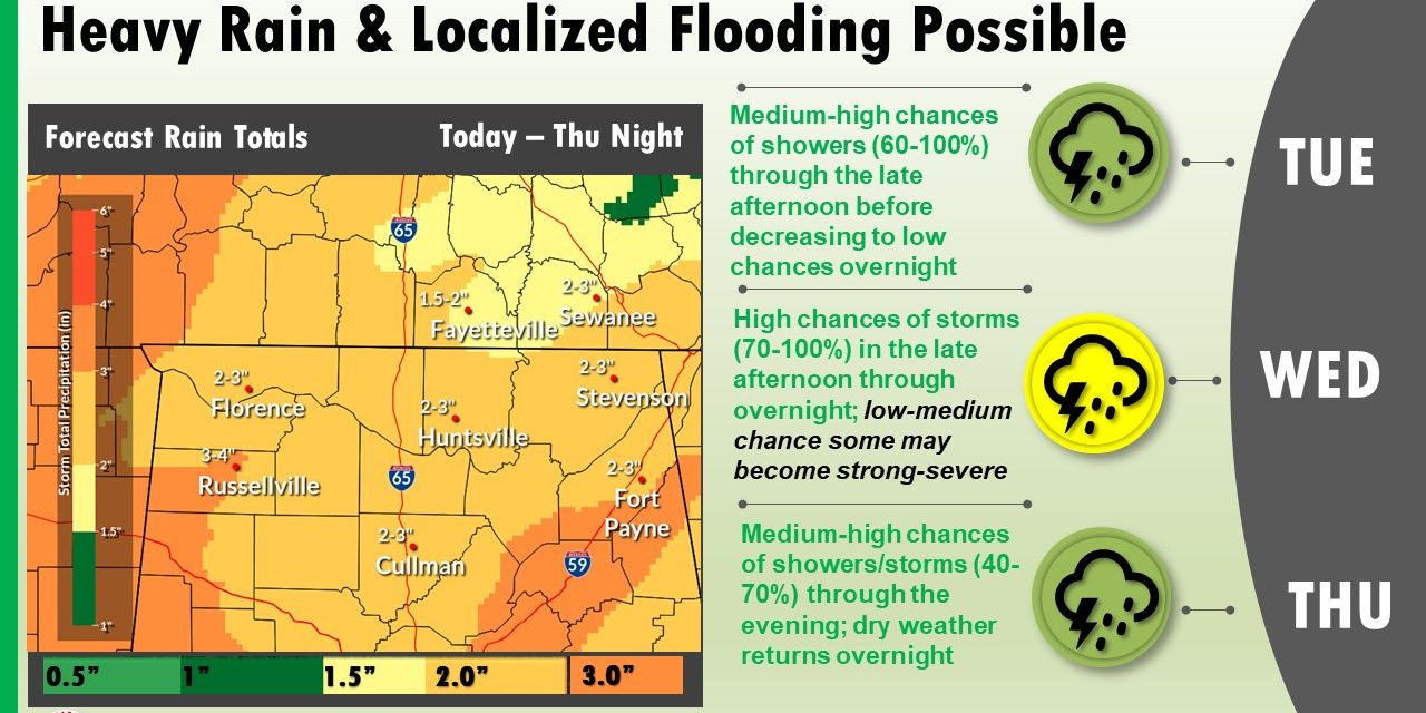
Meanwhile, for this week, multiple rounds of rainfall will cause flooding concerns through the Tennessee Valley, according to the National Weather Service Huntsville office. The highest chances of heavy rainfall will be Wednesday into Thursday.
 “Storm total rainfall today through Friday is 2-4” with locally higher amounts possible,” the weather service said. “This will likely cause rises on rivers, streams, and creeks in addition to runoff flooding low-lying areas.”
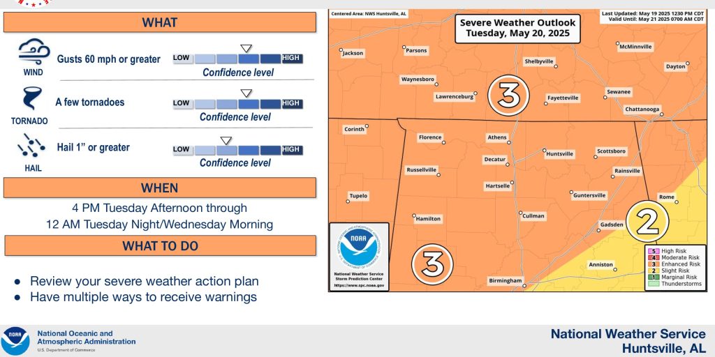
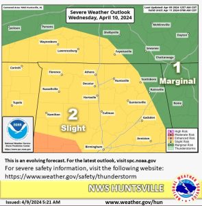
The office also said a low-medium chance of strong to severe storms is possible Wednesday as a cold front approaches the Tennessee Valley from the west.
“As storms move in from the west in the form of a broken line, there is a low-medium chance they become strong to severe,” the office said. “If any strong storms develop, gusty to damaging winds will be the main threat. A hail and tornado threat also exists, however, confidence is low in this.”
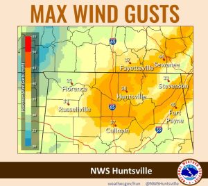 The storms, which are on the leading edge of a cold front, will bring windy conditions with gusts up to 30-40 mph are possible and up to 45 mph in higher elevations.
The weather service warned that downed trees and power lines are possible due to saturated soils as heavy rainfall impacts the area through the mid-week.
But there is relief coming. Dry air filters in behind the front Thursday night and dry conditions return to the Tennessee Valley for the weekend