
HUNTSVILLE — Forecasters are calling for about a 50-70% chance of rain and thunderstorms across North Alabama this afternoon.
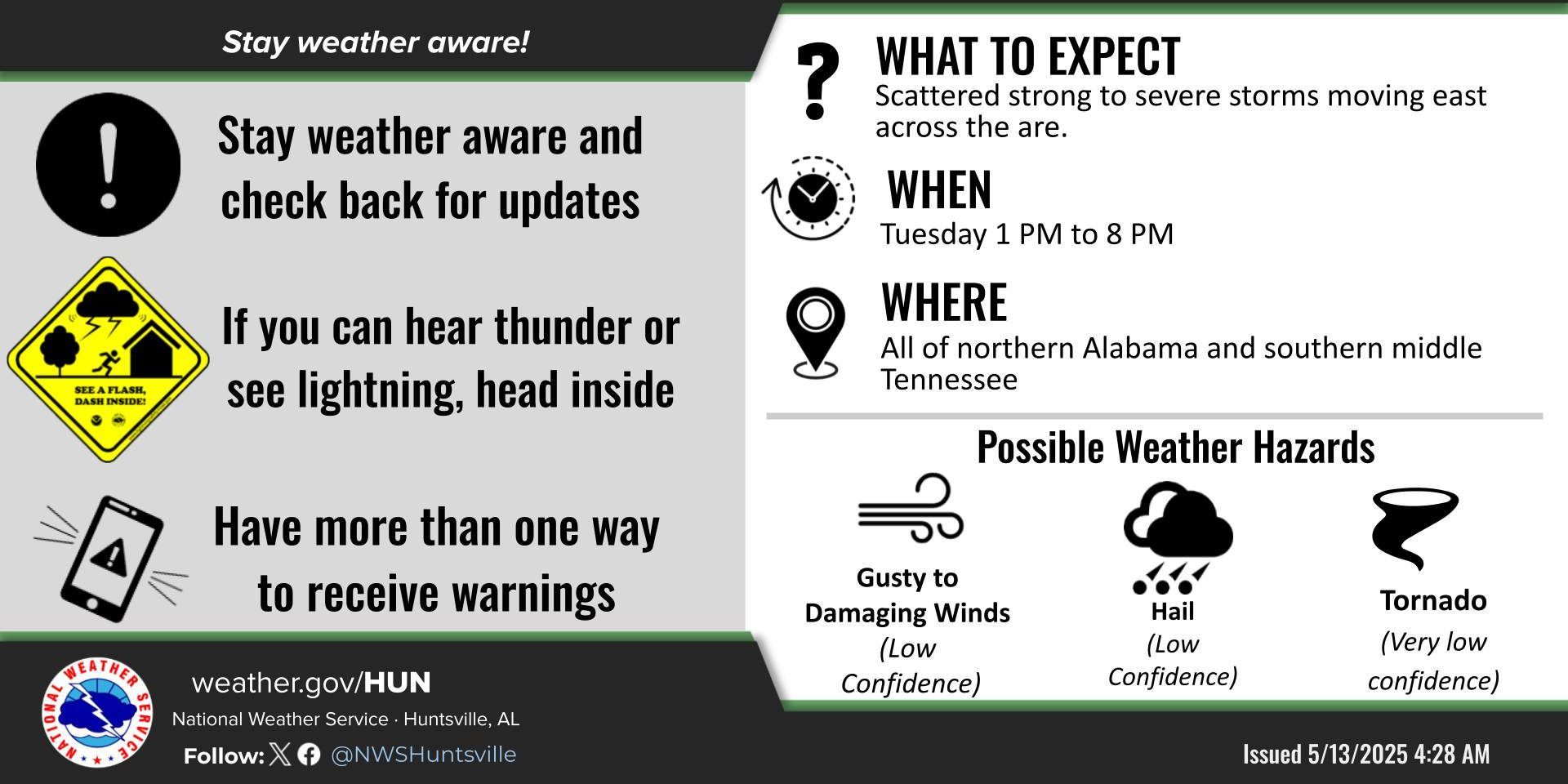
“A few strong to marginally severe thunderstorms may develop (this) afternoon and evening,” the Huntsville office of the National Weather Service said. “Otherwise, thunderstorms are forecast to remain below severe limits.”
The office said it will be watching to see if a weak front sets up in northwest Alabama near the Bankhead – this would locally increase severe probabilities this afternoon, including the potential for a tornado.
Clusters of thunderstorms (a few strong to severe) may develop in Mississippi and move east across north Alabama. Forecasters said the main window is from 1-8 p.m. today.
“The best chances for strong to severe storms will be across portions of north central and northwest Alabama, with wind/hail being the main threats,” forecasters said. “A weak boundary may develop this afternoon in northwest Alabama that could help support a low, localized tornado threat.”
Drier conditions will build back in Wednesday and Thursday with low rain and thunderstorm chances each afternoon (10-20%).
A low pressure system will approach Friday and stall over the area through the weekend. This will create a risk for some strong to severe storm Friday evening into overnight.


