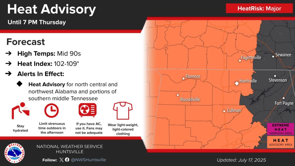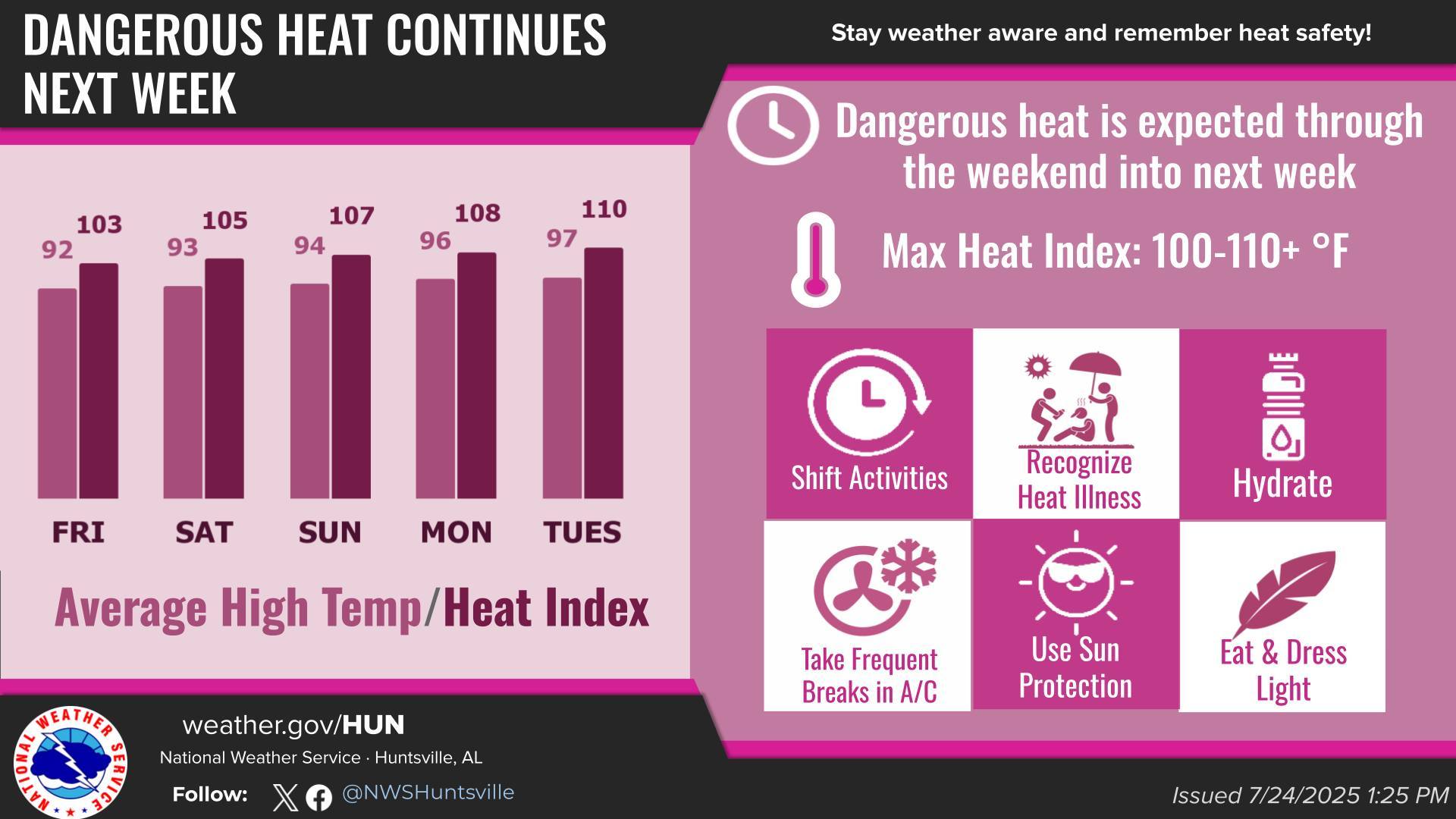
HUNTSVILLE — After highs in the upper 80s to lower 90s today and Saturday, a more substantial heatwave is forecast to develop during the early to middle part of next week (Sunday through Wednesday).
According to the National Weather Service Huntsville office:
- Highs are expected to reach the mid- to upper 90s each day, potentially reaching 100
degrees in some locations Tuesday and Wednesday. - Heat index values are expected to reach the 105-110 degree range each day, potentially
reaching 110-115 degrees in some locations Tuesday and Wednesday. - Additional heat advisories or extreme heat warnings may be issued during this
time.
Meanwhile, there is a medium (30-40%) chance for general thunderstorms today and Saturday, and low (10-30%) chances for general thunderstorms Sunday-Wednesday. Rain chances will increase once again by next Thursday.
Locally heavy downpours and frequent lightning will be the main storm impacts, the weather office said.