HUNTSVILLE — After a cloudy start to the day, thunderstorms are expected to develop by midday, according to the National Weather Service Huntsville office.
There will be a few showers possible this morning, especially across northeast Alabama, the office said.
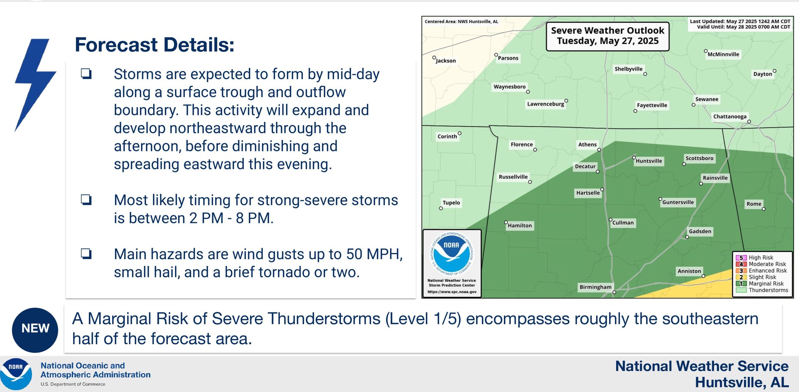
“Storms will expand in coverage as they spread northeastward this afternoon, mainly impacting locations east of I-65,” the forecasters said. “A few instances of small hail and wind gusts up to 50 mph will be possible, along with a brief tornado or two.”
Temperatures will be in the 70s throughout the day.
Precipitation will begin to diminish and spread eastward this evening, with conditions becoming favorable for development of fog early Wednesday morning.
There will be less chances of storms Wednesday – compared to previous days – but showers or thunderstorms will redevelop throughout the day Thursday and continue through Friday morning.
Wednesday’s high will be 80 degrees while Thursday’s high is just 75 degrees and Friday’s is an unseasonable high of 71 degrees.
A few storms could be strong to severe, especially immediately ahead of an approaching front, late Thursday night into Friday morning. These will pose a risk for strong winds and some hail, forecasters said.
While gusty northwest winds as well as wrap-around clouds and light rain will be possible from Friday afternoon-early Saturday morning, the weekend will be dry with high temperatures in the upper 70s.