HUNTSVILLE — The unsettled weather continues this week with a 70-90% chance of showers and storms today, according to the National Weather Service Huntsville office.
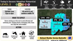
There is a potential of “strong to severe storms this afternoon into the evening hours across the Tennessee Valley – bringing threats of damaging winds, heavy rain, hail, and tornadoes,” the office said.
However, a repeat of last week’s tornadoes and severe weather is unlikely.
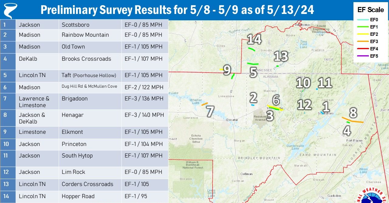
The weather service said 14 tornadoes have been confirmed from the “severe weather event” last Wednesday into Thursday.
“Additional survey teams are going out again (today) which could result in additional tracks and/or changes to current tracks,” the office said.
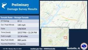
The Henagar tornado injured seven people, the NWS said. It was an EF-3 with peak winds of 140 mph and tracked 12.34 miles. The half-mile wide tornado touched down just before 11 p.m. last Wednesday.
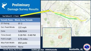
In Huntsville, an EF-2 tornado touched down around 9:30 p.m. last Wednesday and tracked nearly 10 miles. It had peak winds of 122 mph and its path was 850 yards wide. There were no injuries.
Huntsville received a second punch an hour later when an EF-1 hit the area. With winds of 100 mph, it tracked nearly 6 miles and was 600 yards wide.
For the rest of this week, after a break from the showers and storms Thursday, unsettled weather is slated to return Friday.
“However, confidence on the potential of strong to severe storms is low at this time,” the forecasters said.
For Wednesday night through Thursday, there are no rain chances with highs reaching the lower to mid 80s Thursday.