HUNTSVILLE — “When it rains, it pours.” This old adage is timely with our recent weather.
And, “it ain’t over ’til it’s over.”
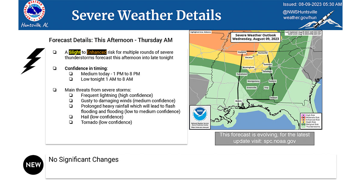
The National Weather Service Huntsville office is forecasting rounds of thunderstorms to move across the Tennessee Valley this afternoon through Thursday.
“Some strong to severe storms are forecast to impact the area,” the office said. “The first round is forecast to move in from the west between 1 and 8 p.m.
“The storms will bring threats of lightning with gusty to damaging winds.”
The office also said there is a strong likelihood for flooding from the prolonged heavy rainfall.
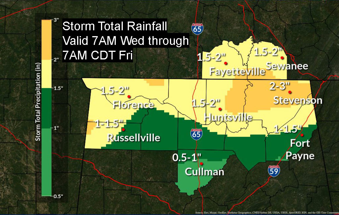
“The current total rainfall forecast is from one to three inches,” the NWS said. “The flooding threat will increase if storms train (move over the same area repeatedly).
“This will be especially dangerous at night when flooded roads are hard to see.”