HUNTSVILLE — Don’t put those umbrellas away, yet.
Or the winter coats.
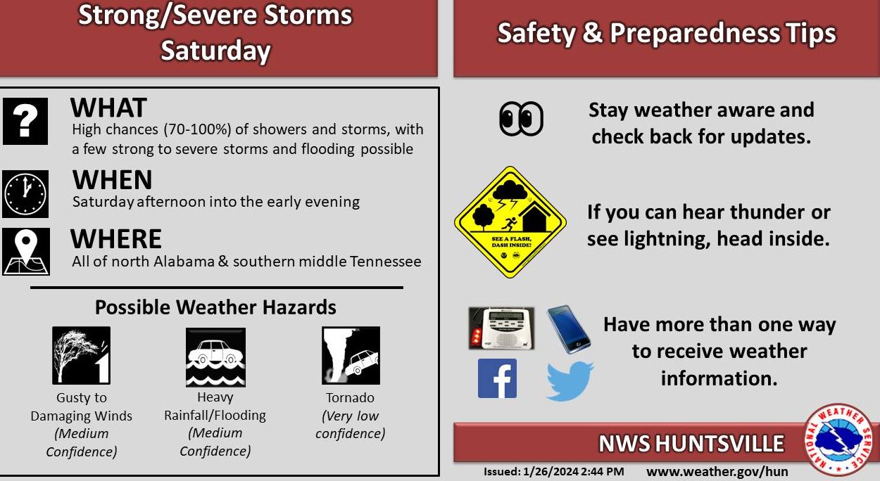
The National Weather Service Huntsville office is calling for a chance of rain and storms late tonight across the area, peaking to near 100% Saturday morning before gradually decreasing Saturday afternoon and evening as a cold front move across the area.
“The severe weather threat is forecast to develop just ahead of a cold front during the afternoon hours,” the office said.
And we’ll feel the cold front as Saturday’s high of around 65 at noon will drop some 20 degrees in a matter of a few hours. Sunday’s high will be 47 degrees. The rest of the week will see highs in the mid 50s and lows in the 30s.
In the meantime, heavy rain is possible Saturday, with rainfall amounts from 1 to 2 inches. There could be minor instances of flash flooding if storms move over the same locations repeatedly, the office said.
“The main threats with any strong to severe storms will be gusty to damaging winds and frequent lightning, but a tornado or two cannot be ruled out,” the office said.