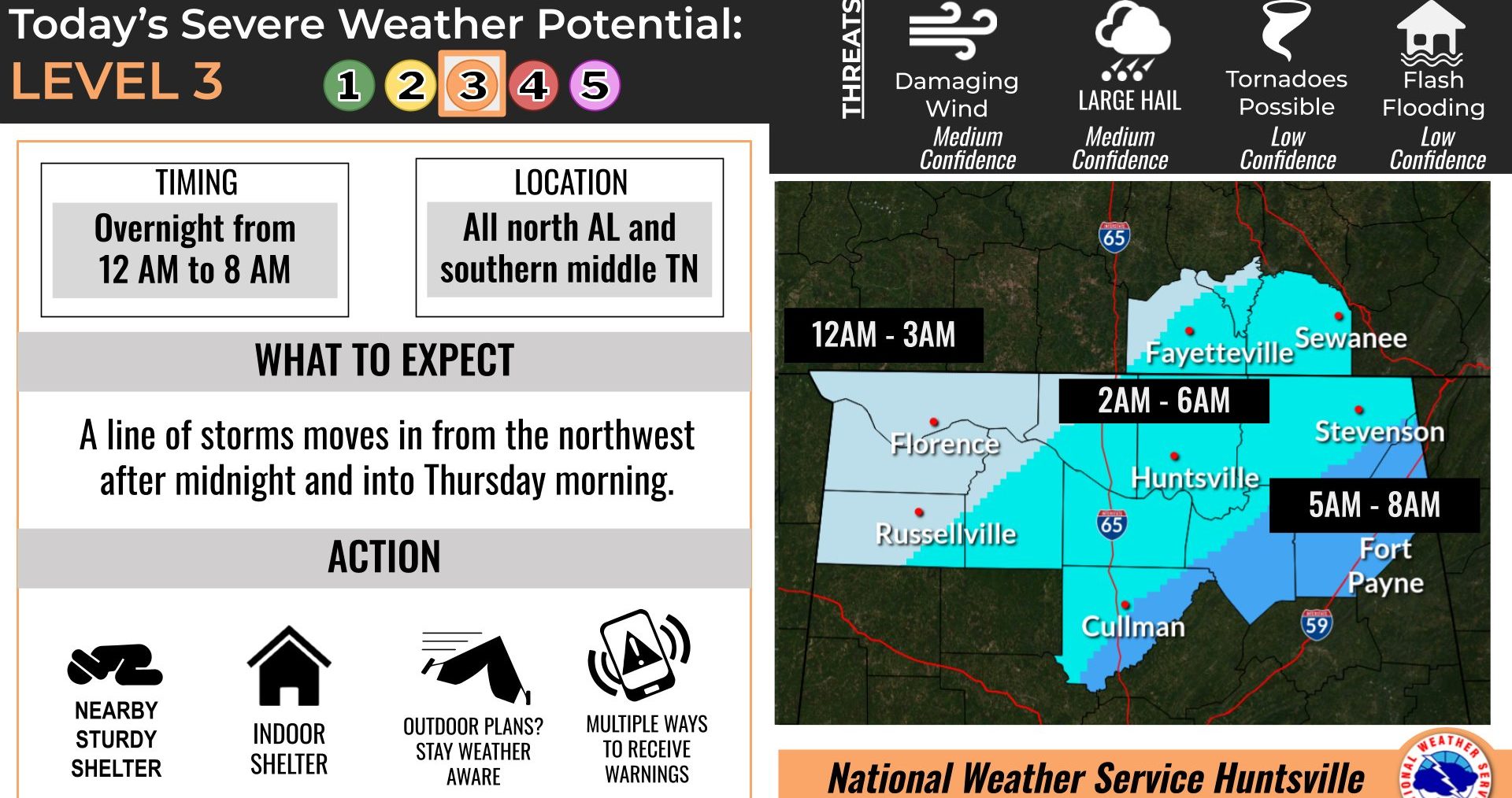
HUNTSVILLE — Severe storms northwest of the state will push into the Shoals around midnight then move southeastward overnight, according to the National Weather Service Huntsville office.
“All severe hazards are possible, including large hail, damaging winds, and tornadoes,” the office said today.
This is the second round of storms after Tuesday’s first round of heavy rain and reports of ping pong-ball size hail in northeast Madison County.
Forecasters said they are looking at how the line of storms orients itself. A better defined convective line of storms would result in increased severe potential while a “messy” looking orientation of storms may lower the overall severe potential.
The storms are expected to pass through the area quickly, minimizing the chance of localized flash flooding.