HUNTSVILLE — You may want to postpone outdoor plans for this weekend. It’s going to be a wet, windy and stormy one – particularly Saturday afternoon and Saturday night.
“A strong storm system is forecast to intensify to our west and move into the Tennessee Valley Saturday afternoon/evening into Saturday night,” the National Weather Service Huntsville office said Friday. “This will bring widespread (80-100% of the Valley) heavy rainfall and some thunderstorms (30-50%) to the area.
 “Storm rainfall totals of 1 to 3 inches are forecast, with locally higher amounts possible.”
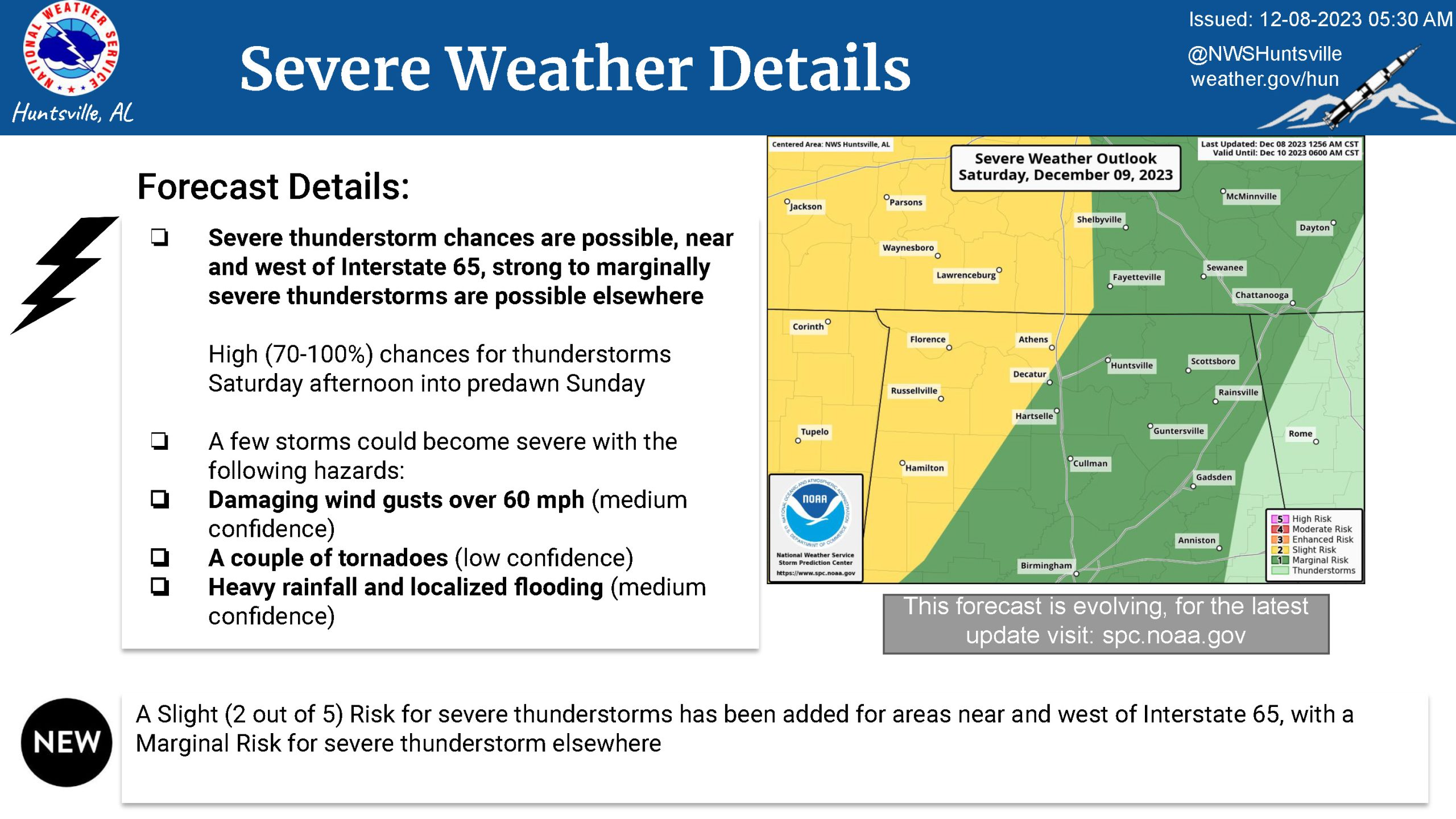
The Storm Prediction Center has placed areas of the Tennessee Valley, mainly near and west of Interstate 65 into a Slight Risk (2 out of 5) for severe thunderstorms, the office said. Areas to the east are under a marginal risk for severe weather.
“There are high (70-100%) chances for thunderstorms Saturday afternoon into predawn Sunday,” the office said. “A few storms could become severe with the following hazards: Damaging wind gusts over 60 mph (medium confidence), a couple of tornadoes (low confidence), and heavy rainfall and localized flooding (medium confidence).”
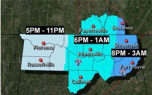 The forecast is also calling for a potential for heavy rainfall/flooding and strong to damaging wind gusts beginning late Saturday afternoon into early Sunday morning.
“Rain chances will increase during the day Saturday, with the highest chances Saturday night to early Sunday,” the weather service said. “Rainfall amounts should range from 1-3 inches across the area, with an average of 2 inches in most spots.
“There is a risk for flash flooding should excessive amounts of rainfall fall in a short time.”