
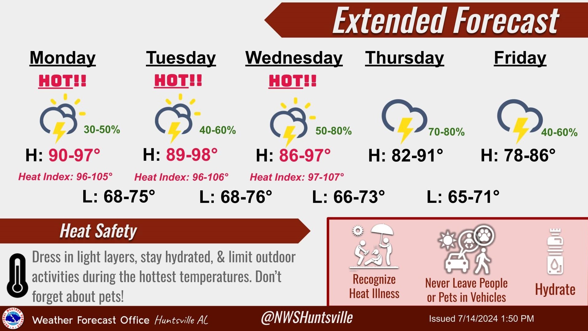
HUNTSVILLE – Potentially dangerous hot weather continues this week with heat indexes, or “feels like temperatures,” moving into the 100s in the Tennessee Valley. However, help could come in the way of rain later in the week when a cold front moves through Wednesday.
The recent heatwave also places an emphasis on a five-month open burn ban that began for 12 Alabama counties May 1 and expires Oct. 1. Parts of Madison, Jackson, Limestone, and Lauderdale Counties are under a severe drought with other areas also experiencing abnormally dry conditions.
The National Weather Service Huntsville forecasts highs in the upper 80s to upper 90s and lows in the upper 60s to mid 70s. Peak heat index values will be in the 96- to 107-degree range during these days depending on location and elevation.
There will be some relief from the heat thanks to increasing chances of showers and thunderstorms each day, bringing a risk of sudden lightning, gusty winds and heavy downpours.
Madison, Morgan, Lawrence, DeKalb and Etowah counties are among those placed in the five-month open burn ban. It was mandated to protect air quality and reduce the fire risk during the dry summer months.
This ban prohibits creating campfires or vegetation burns. People who violate the ban can be fined. Cooking or “warming’’ camping fires are allowed.


