HUNTSVILLE — The National Weather Service is calling for a “multi-day rainfall event” that can start as soon as this afternoon in the Tennessee Valley.
The event is due to storms associated with a stalling cold front followed by impacts from a tropical system later in the week, the NWS Huntsville office said this morning.
Northeast Alabama and portions of southern middle Tennessee could see rainfall totals from 6-8 inches, forecasters said.
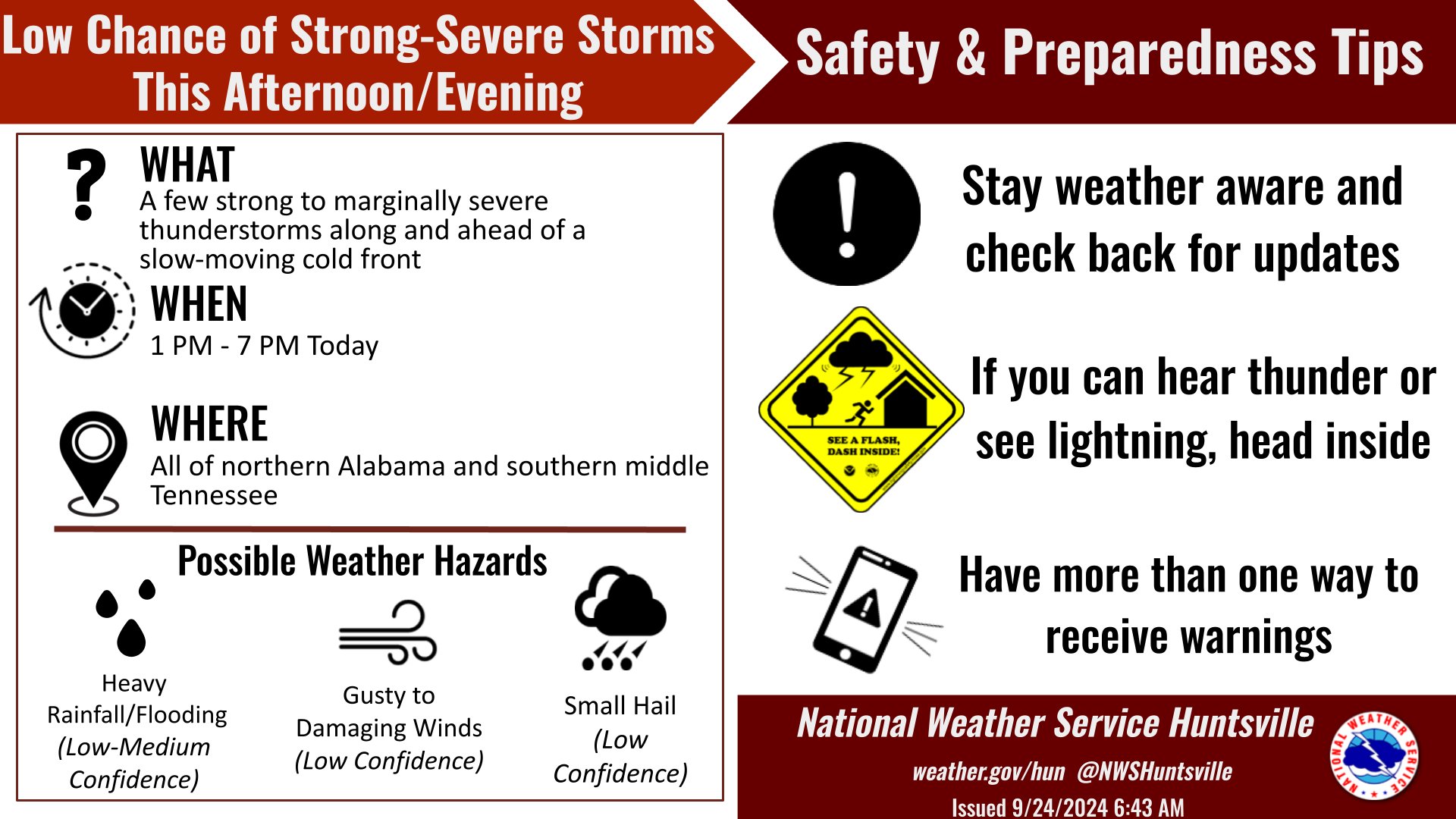
“Strong to marginally severe thunderstorms will be possible along a slow-moving cold front this afternoon and early this evening,” the office said. “The front will gradually stall across our region tonight and remain stationary through Wednesday night, focusing the risk for heavy rainfall and embedded storms across the southeastern portion of the region.”
The office said rain and wind impacts from what could eventually develop into Hurricane Helene may begin in our region as early as Thursday and continue through Friday.
Forecasters said they are watching the storm environment this afternoon and the area could see locally damaging winds and small hail.