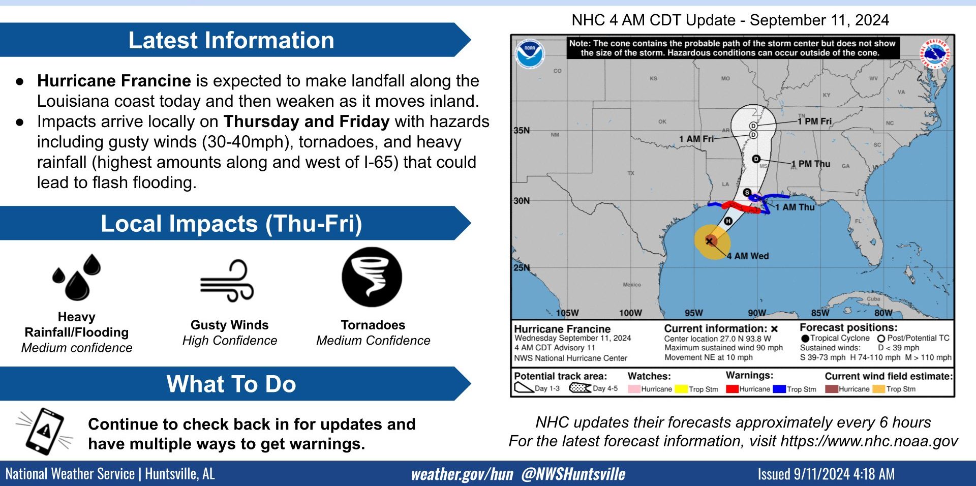
HUNTSVILLE — As Hurricane Francine makes landfall in Louisiana today, gusty winds are forecast in the Tennessee Valley this evening and continuing through early Friday
afternoon.
Francine is expected to weaken to a tropical storm then tropical depression as the system lifts to the north-northeast and approaches the Mid South and Tennessee Valley regions, according to the National Weather Service Huntsville office.
Local impacts Thursday and Friday include gusty winds, possible tornadoes, and heavy rainfall/flooding.
“Sustained winds around 20-25 mph with gusts near 30-40 mph are forecast,” the office said. “Total rainfall amounts are forecast to be around 1-3 inches with a low chance of locally higher amounts up to 3-4 inches, with heavier rainfall west of I-65.
“Due to recent drought, we will be monitoring how this rainfall affects flooding potential.”
Meanwhile, today will be cloudy w/ highs in the upper 80s.