HUNTSVILLE — In the words of late singer/songwriter Glenn Frey, “The heat is on.”
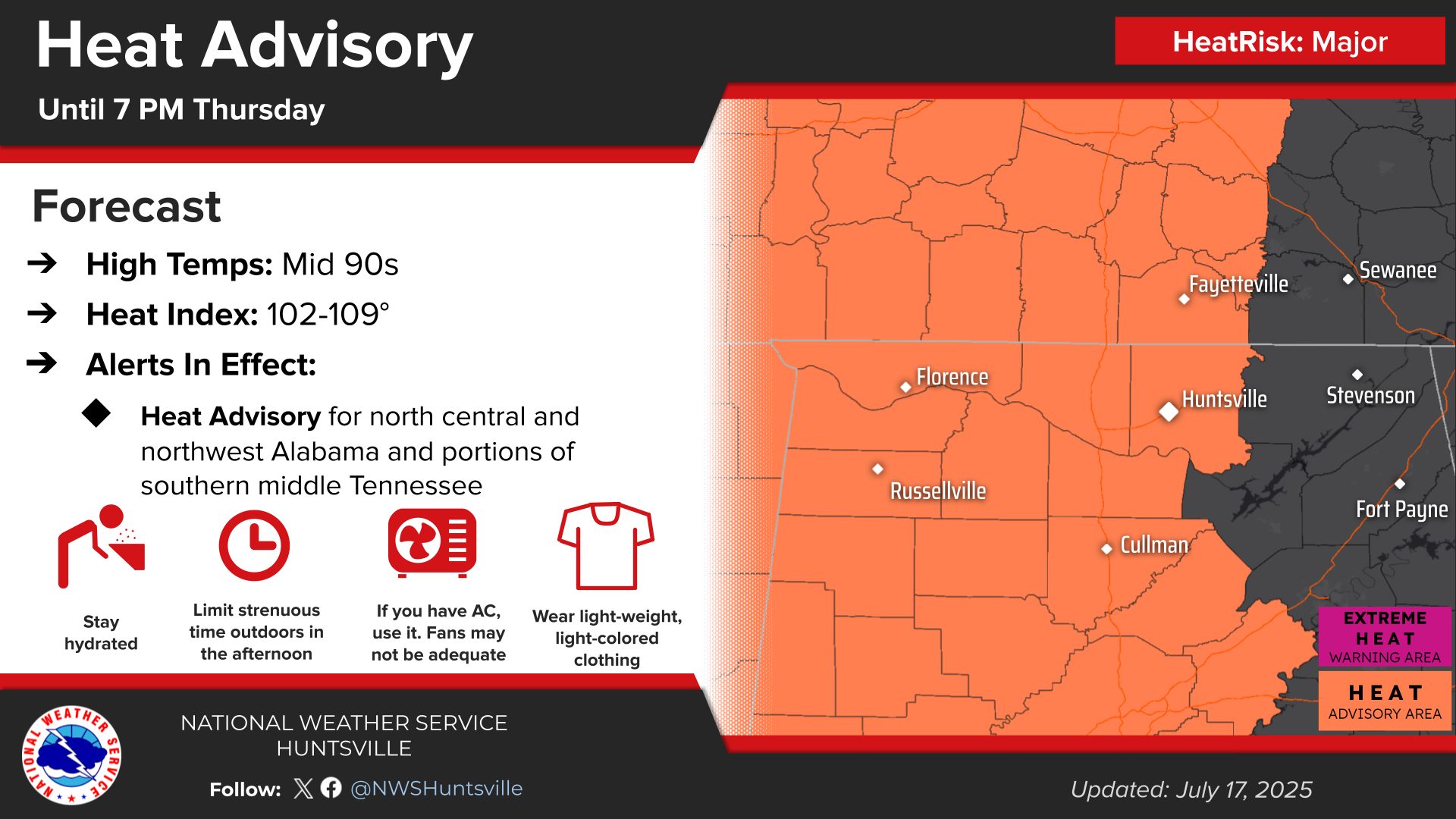
And unrelenting heat is what we have to look forward to over the next several days, with the area under a heat advisory until 7 o’clock this evening.
Heat index values of 105 to 109 degrees are forecast from the Shoals to Madison County and portions of southern middle Tennessee today, according to the National Weather Service Huntsville office.
And, it’s not going to be much better for the weekend, despite increasing chances of storms.
Friday through the weekend, heat index values will be in the upper 90s to 106-degree range.
A few stronger storms may develop each afternoon, with brief gusty winds (30-50 mph), along with locally heavy rainfall/flash flooding being the primary threats.
Storms will be in more of a tropical-like air mass, continuing the concerns of locally heavy rainfall that could lead to flash flooding.
Meanwhile, an even hotter heat wave is on the horizon for late next week.
“The heat is on (yeah!)
“The heat is on (oh, yeah)
“The heat is on (burnin’, burnin’, burnin’)
“It’s on the street (woo-hoo)
“The heat is … on.”