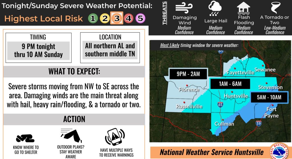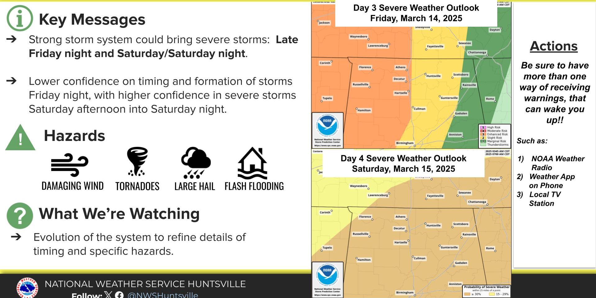
HUNTSVILLE — The National Weather Service Huntsville office isn’t pulling any punches.
“Residents in the Tennessee Valley should be prepared for an overnight event Friday
night,” its statement read. “The threat to life and property will be higher while many are asleep.
 “Be sure to have multiple ways to receive warnings capable of waking you up.”
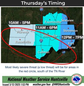
However, the wet weather could start as soon as Thursday, the office said. There is a low chance of an isolated strong/severe storm Thursday morning through afternoon.
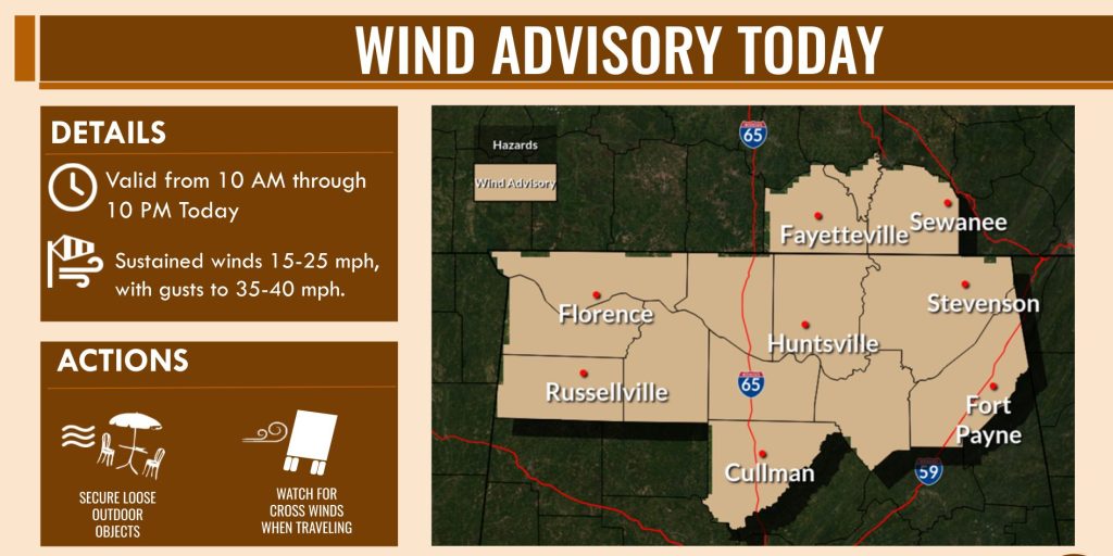
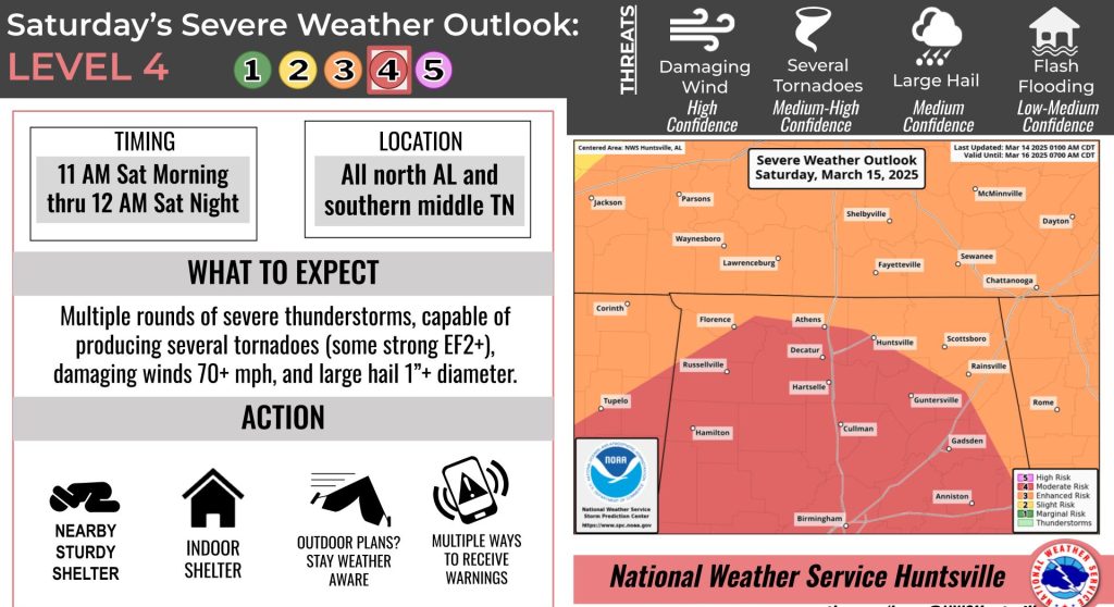
“A potent storm system will set up into the weekend, with multiple rounds of storms bringing a threat for both severe storms and flooding Friday night through Saturday and Saturday night,” forecasters said. “Gusty non-thunderstorm winds (30-40 mph) are expected on Friday, as well.”
The storms will bring 2-3 inches of rain with localized totals up to 4-5 inches. This could lead to rises on area rivers and streams as well as flooding/flash flooding.