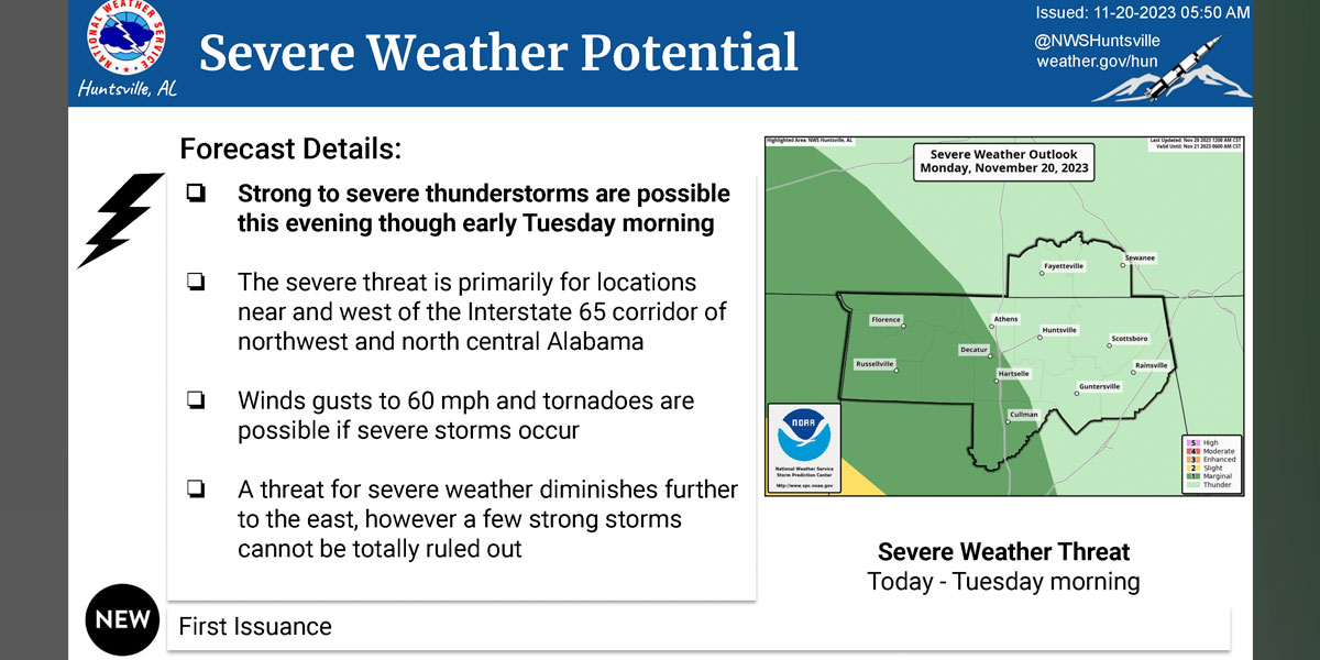
HUNTSVILLE – A low pressure system moving into the state today could produce severe storms, particularly in areas west of I-65.
But it’s heavy rains and high winds that are most concerning as the weather moves eastward through the Tennessee Valley.
“There is a low chance for strong to severe storms this evening into Tuesday morning,” the National Weather Service Huntsville office said this morning. “These will bring threats of gusty to damaging winds, a tornado or two, and locally heavy rainfall.
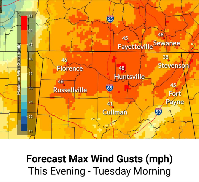
“Wind gusts of 40-50 mph are expected through daybreak Tuesday.”
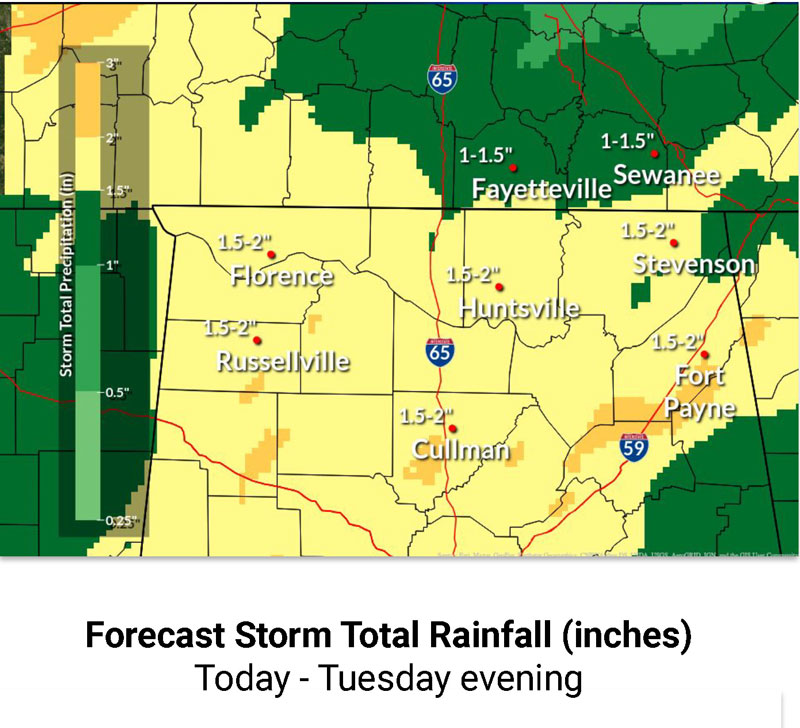
The office is predicting heavy rain today and Tuesday with up to three inches possible in some places across the Tennessee Valley.
“Very heavy rainfall will also accompany the system as it traverses the region,” the office said. “Rainfall totals of 1 to three inches are forecast. Very heavy amounts of rainfall in a short time can run off and produce flash flooding.”
This is a increased chance of a flood threat if the “storms train (move over the same area repeatedly),” the weather service said. “This will be especially dangerous in the evening/overnight when flooded roads are difficult to see.”
What the NWS calls “breezy’’ conditions with a chance of showers are forecast for Tuesday. There’s a slight chance of rain Tuesday night. Wednesday will be partly sunny as will Thanksgiving Day. The chance of showers returns by nightfall.
Timeline for Huntsville:
- Today: A slight chance of showers before 9 a.m., then a chance of showers after 5pm. Partly sunny, with a high near 70. Southeast wind 10 to 15 mph, with gusts as high as 30 mph. Chance of precipitation is 30%.
- Tonight: Showers, with thunderstorms also possible after midnight. Some of the storms could produce heavy rainfall. Low around 58. Windy, with a southeast wind 20 to 25 mph, with gusts as high as 45 mph. Chance of precipitation is 100%. New rainfall amounts between three quarters and one inch possible.
- Tuesday: Showers and possibly a thunderstorm. High near 68. Breezy, with a south southeast wind 10 to 20 mph becoming west in the afternoon. Winds could gust as high as 35 mph. Chance of precipitation is 90%.
- Tuesday night: A 20% chance of showers before midnight. Mostly cloudy, with a low around 45. Northwest wind around 10 mph, with gusts as high as 20 mph.
- Wednesday: Partly sunny, with a high near 53.
- Wednesday night: Partly cloudy, with a low around 36.
- Thanksgiving Day: A 2% chance of showers after noon. Partly sunny, with a high near 58.
- Thursday Night: A 30% chance of showers. Mostly cloudy, with a low around 43.