HUNTSVILLE — If you have plans for today and Wednesday, make sure they include an umbrella or raincoat.
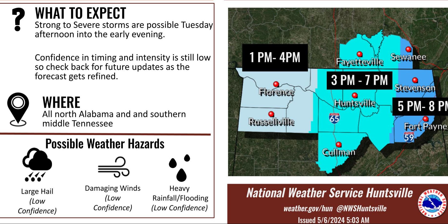
“Two potential rounds of severe storms are possible this week,” the National Weather Service Huntsville office said. “Round 1 – storms are expected to develop in the Shoals in the early afternoon then move eastward
“The thunderstorms should then move out and weaken by the early evening.”
Round 2 comes Wednesday as a complex of severe thunderstorms is expected to form across Missouri and Arkansas in the afternoon and arrive in the Tennessee Valley after midnight through early Thursday.

“Main hazards include large hail, damaging winds, and tornadoes,” the weather office said. “Localized flooding may become an issue if storms train over the same area given the potential for multiple rounds of rainfall this week.”