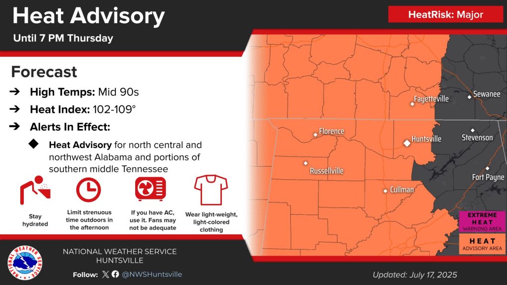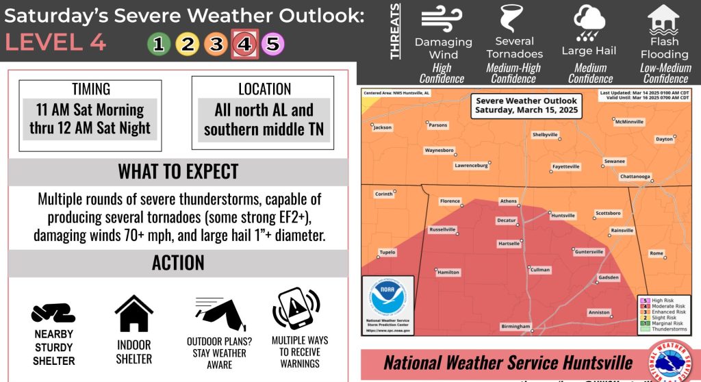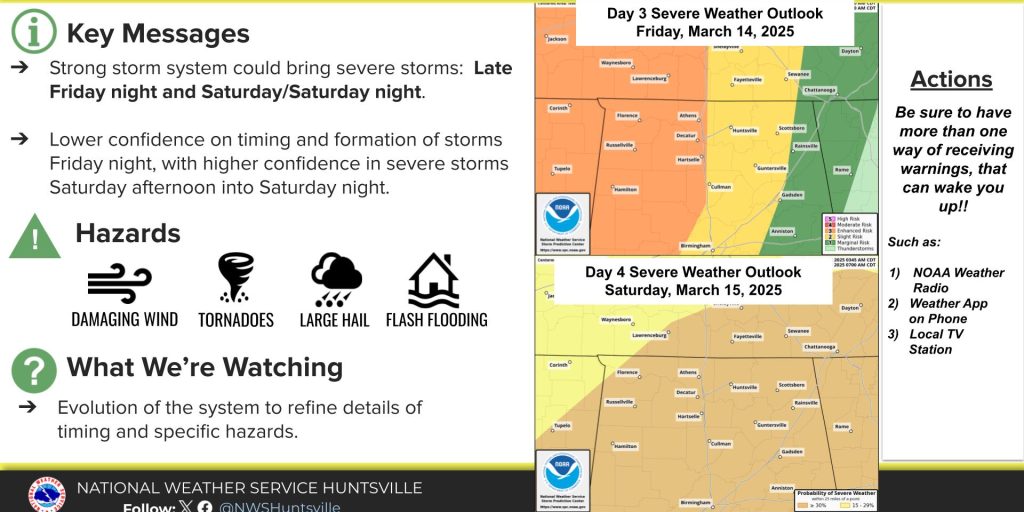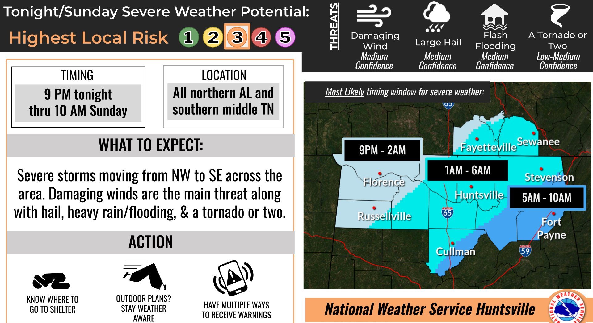
HUNTSVILLE — Little has changed with the forecast for today through Sunday.
The National Weather Service Huntsville office is forecasting severe storms to slowly progress over the Tennessee Valley tonight through Sunday morning.
“Severe weather probabilities are low to medium, with the greatest probabilities over northwest and north-central Alabama and southern middle Tennessee,” the office said. “Damaging winds, hail, heavy rain/flooding, and a tornado or two will all be threats.”
There remains uncertainty in exact timing, but the most likely timing for storms entering northwest Alabama is around 9 p.m., moving east of north-central Alabama around 6 a.m. Sunday and east of northeast Alabama around 10 a.m. Sunday.
The forecasters said severe probabilities will gradually decrease as storms move into northeast Alabama late tonight into early Sunday morning, but damaging winds, a tornado, and heavy rain/flooding will continue to be the main hazards.