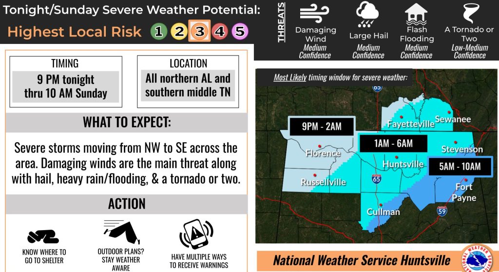
HUNTSVILLE — Recent trends continue to indicate a significant severe weather event will shape up over the Tennessee Valley tonight and Saturday, according to the National Weather Service Huntsville office.
“A potent storm system will set up into the weekend, with multiple rounds of storms bringing a threat for severe storms and flooding tonight through Saturday into Saturday night,” the forecasters said. “A few supercell storms will develop across the Southeast (tonight), capable of producing tornadoes, large hail, and damaging wind gusts.”
According to the NWS, the most likely scenarios are:
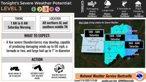
Midnight tonight to 6 a.m. Saturday
- Severe: A few supercell storms develop across the Southeast, capable of producing tornadoes, large hail, and damaging wind gusts.
- Flood: Low-end threat, no flooding concerns for this time period.
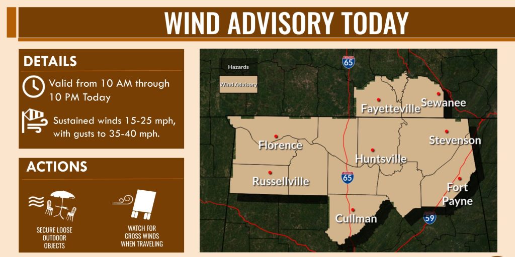
- Gusty winds: Wind gusts start to pick up, reaching 35-45 mph at times.
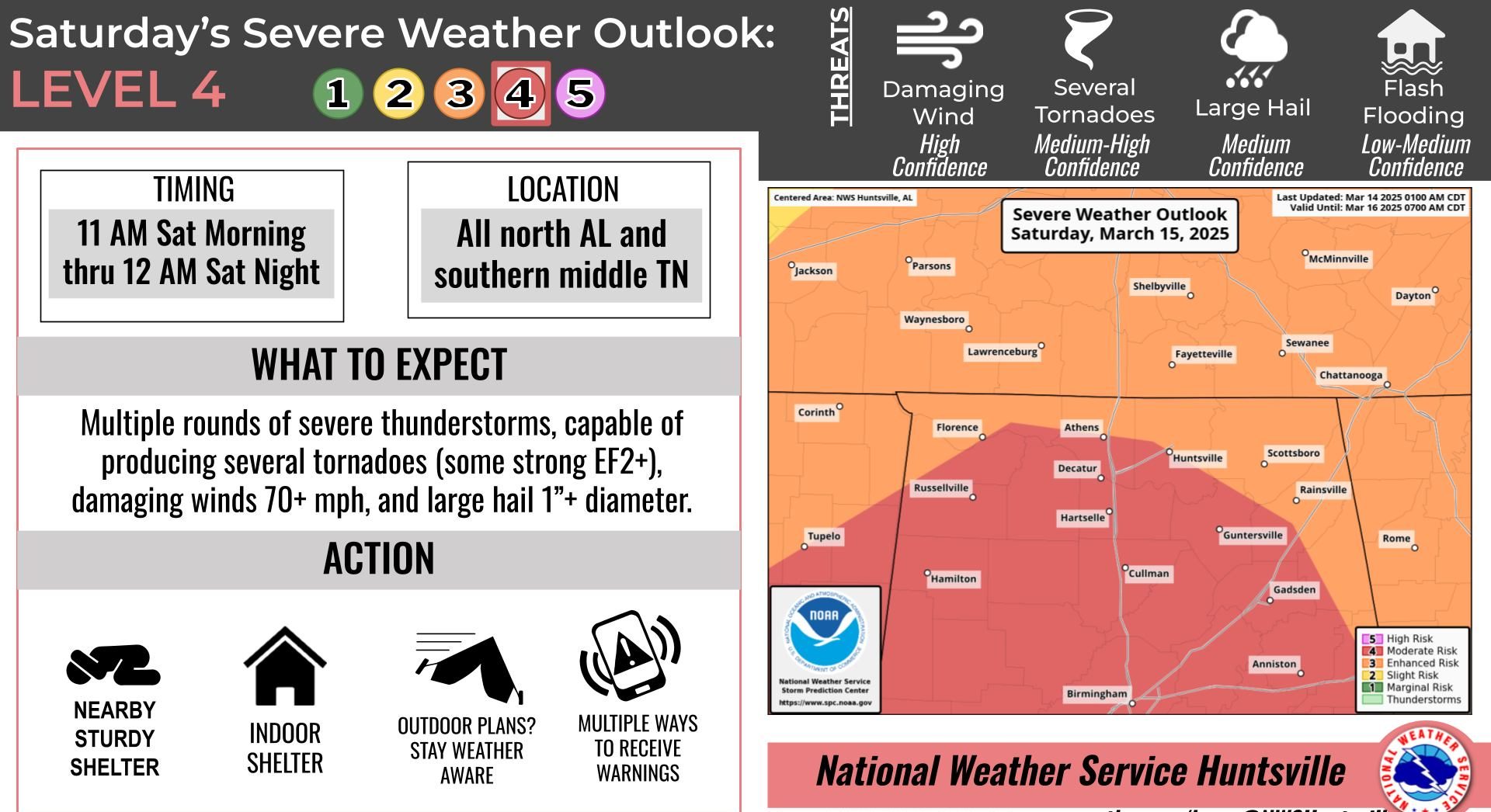
Saturday 11 a.m. to 7 p.m.
- Severe: Additional severe storm clusters develop over the area, capable of producing tornadoes, large hail, and damaging wind gusts.
- Flood: Low-end threat, no flooding concerns for this period.
- Gusty winds: Gusty winds continue, reaching 35-45 mph at times.
Saturday 7 p.m. to midnight
- Severe: A severe line of storms will cross the area from the west, capable of producing tornadoes and damaging wind gusts.
- Flood: Start to feel impacts of multiple rounds of rain; northeast Alabama localized areas with 3-4 inches of rain accumulated.
- Gusty winds: Continuing gusts up to 35-45 mph.